


-
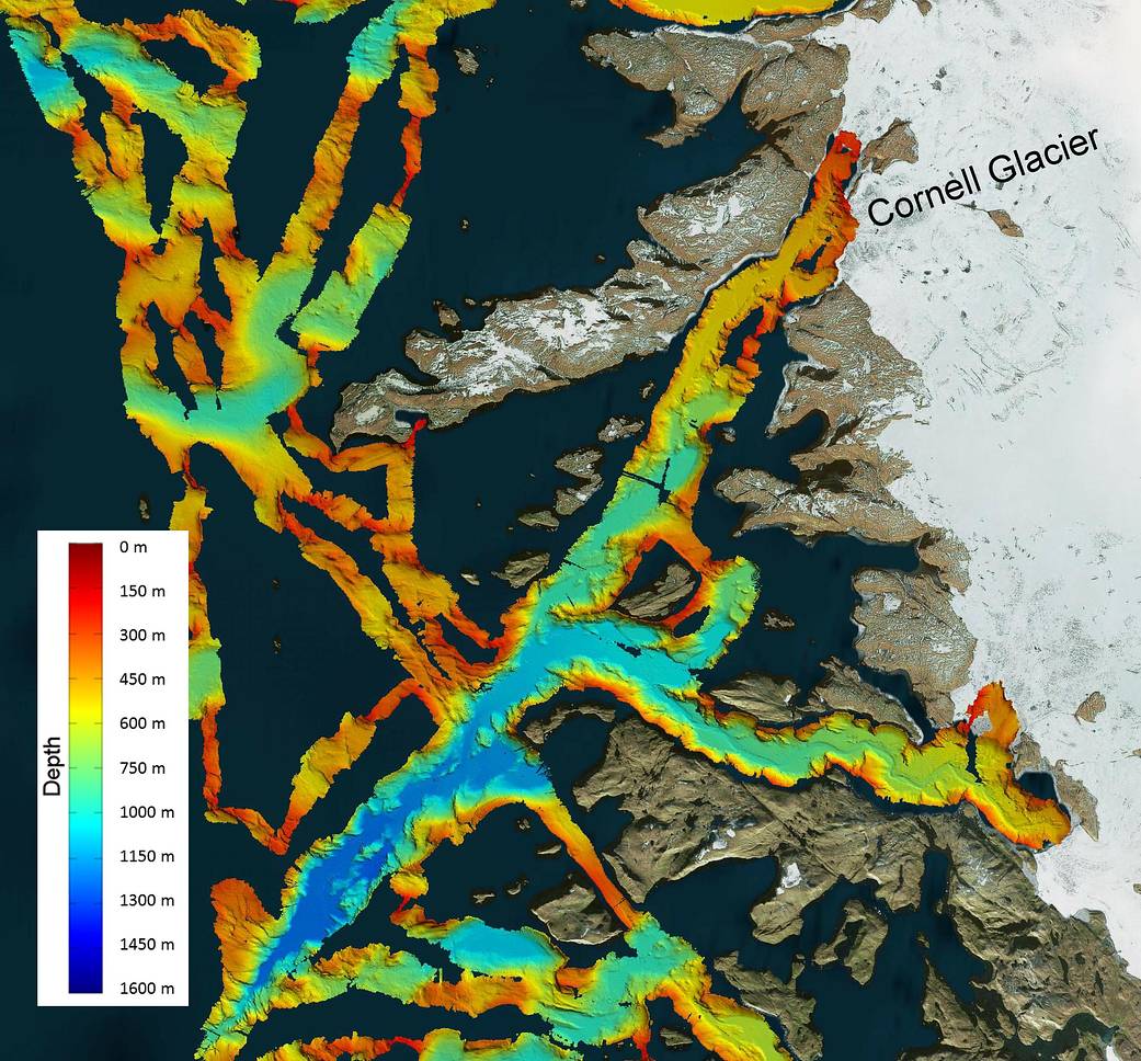
This image shows a region of the sea floor off the coast of northwest Greenland mapped as part of NASA’s Oceans Melting Greenland (OMG) mission. This five-year Earth Ventures Suborbital mission will test the connection between ocean warming and ice loss in Greenland. The data shown here will be used to understand the pathways by which warm water can reach glacier edges. The color overlay on the water shows the depth of the sea floor, with deep blue colors representing depths of more than 1,000 meters. A deep trench extends to the south and west of the Cornell Glacier, shown in the upper right hand corner.
You can learn more about OMG at http://omg.jpl.nasa.gov.
Jet Propulsion Laboratory(JPL) is a Federally Funded Research and Development Center (FFRDC) managed and operated by Caltech under a contract from NASA.
- Image Credit: NASA/JPL-Caltech