


Several fires were burning on Melville Island, located north of mainland Australia on July 20, 2015 at 4:40 UTC (12:40 a.m. EDT), when the Moderate Resolution Imaging Spectroradiometer (MODIS) on NASA’s Aqua satellite passed overhead and captured this image.
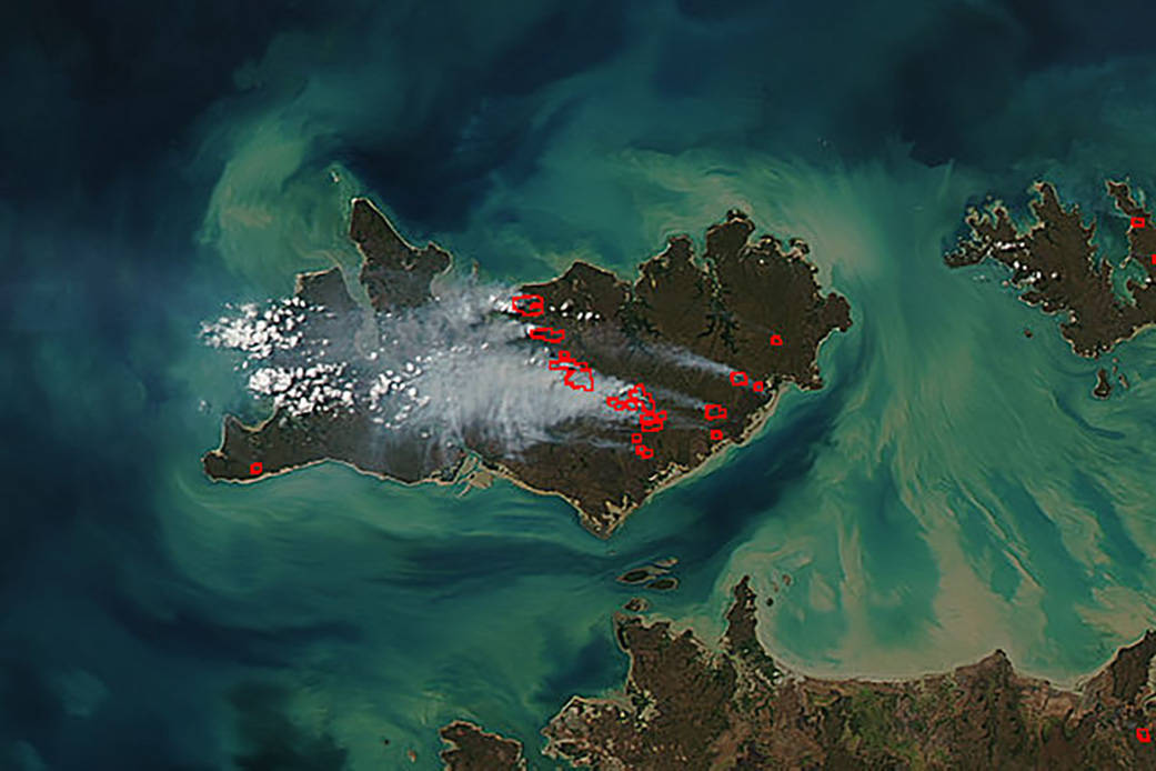
Several fires were burning on Melville Island, located north of mainland Australia on July 20, 2015 at 4:40 UTC (12:40 a.m. EDT), when the Moderate Resolution Imaging Spectroradiometer (MODIS) on NASA’s Aqua satellite passed overhead and captured this image. The places where the sensor detected actively burning fire are outlined in red. Smoke appears in a light brown color and was blowing in a westerly direction.
Melville Island is located in the eastern Timor Sea, off the coast of the Northern Territory, Australia.
Image: NASA Jeff Schmaltz, MODIS Rapid Response Team. Text: NASA Goddard Space Flight Center, Rob Gutro