


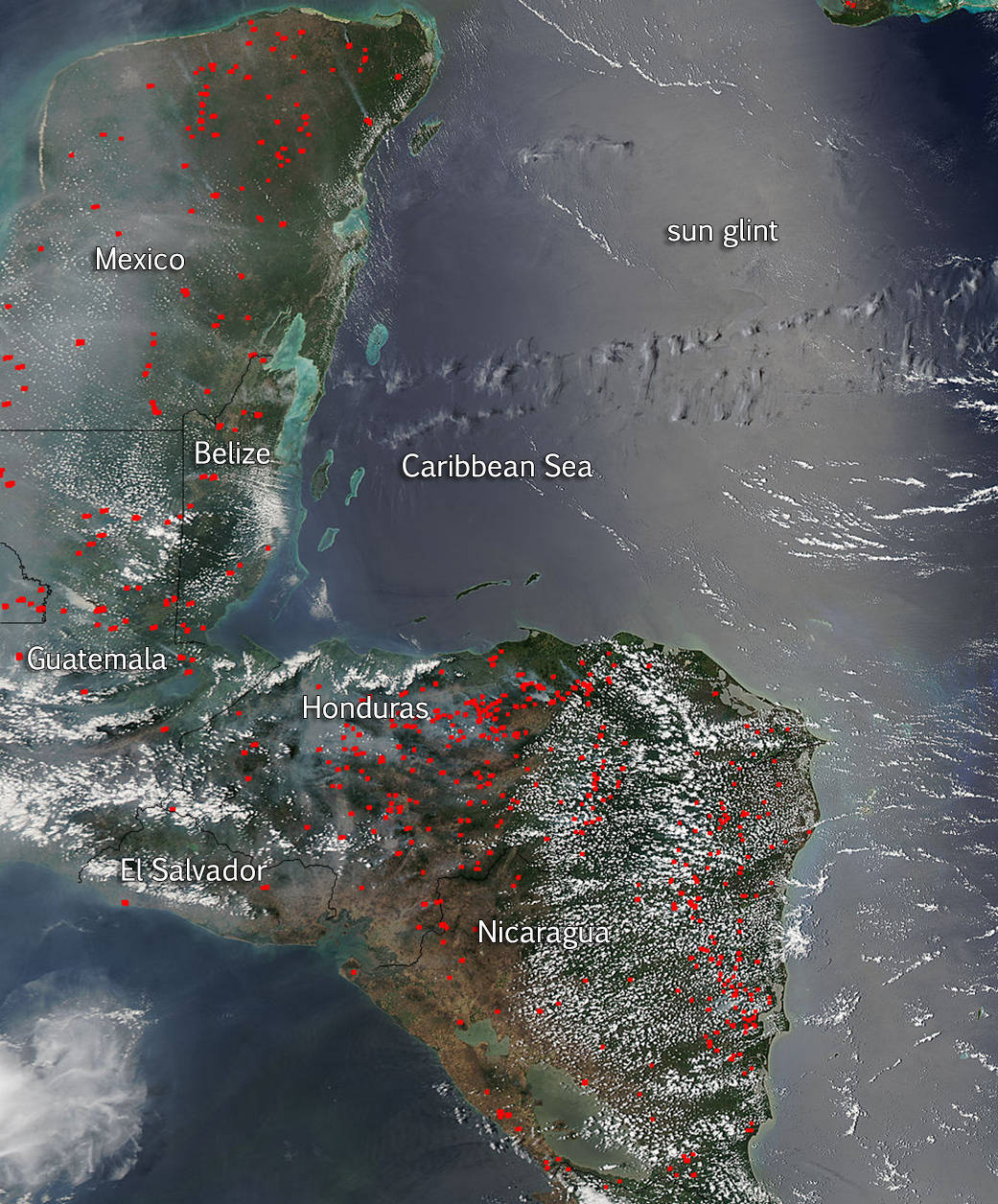
As reported on April 20, dozens of red hot spots covered Mexico’s Yucatan Peninsula. Now the whole of Central America has been captured on fire in this image from April 23, 2015 by the Aqua satellite. Each of hot spot seen in this image, which appears as a red mark, is an area where the thermal detectors on the MODIS instrument recognized temperatures higher than background. When accompanied by plumes of smoke, as in this photo, such hot spots are indicative of fire.
April is prime time in this region for biomass fires deliberately set to manage land for agriculture, especially in forest clearing, working cropland, and renewing pastures. Of course, some may also be wildfires since this is the dry season. Lightning and carelessness are two sources that can cause an outbreak of wildfire. As the dry season progresses, the number of fires tend to grow, as will the pall of smoke which settles over the land. The smoke in this image appears to be blowing westward.
The shiny, silver-toned band aligned in a north-to-south direction on the Caribbean Sea is not smoke. It is sunglint – the mirror-like reflection of the Sun off the water surface.
NASA image courtesy Jeff Schmaltz LANCE/EOSDIS MODIS Rapid Response Team, GSFC. Caption by Lynn Jenner