


According to the Oklahoma Forestry Service (OFS) there are at least 23 fires burning across the state which began due to extreme fire weather ongoing in the area. OFS reports that this weather pattern will remain in place from Thursday (4/12) through Saturday (4/14), and the low humidity and high winds will exacerbate the wildfires spread. Most of Oklahoma is under a red flag warning which is a forecast warning issued by the United States National Weather Service to firefighting and land management agencies predicting that conditions are ideal for wildland fire combustion and rapid spread. OFS is calling this particular weather pattern “almost historic” in its severity with fire weather conditions that have not been seen in more than a decade.
Oklahoma currently has a burn ban in effect in 16 counties in the state: Beaver, Beckham, Cimarron, Custer, Dewey, Ellis, Greer, Harmon, Harper, Jackson, Kiowa, Roger Mills, Texas, Washita, Woods, and Woodward.
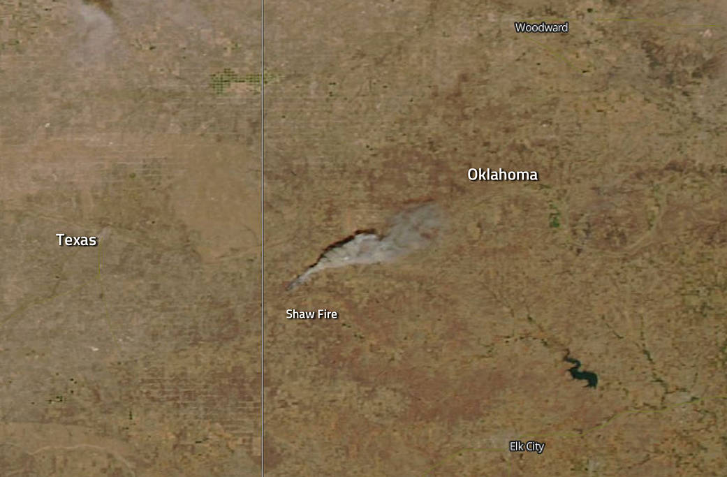
As of 6:00 p.m. on April 12, 2018, the OFS was reporting a new fire, the Shaw Fire, seen in this satellite image, located south of Durham in Roger Mills County near the Black Kettle National Grasslands. Today, April 13, OFS is estimating the fire to be about 3,500+ acres and is being fought by local Volunteer Fire Departments, the OFS Task Force, and Black Kettle National Grasslands.
Daily fire situation reports for Oklahoma can be found: http://www.forestry.ok.gov/situation-reports
NASA’s Aqua satellite collected this natural-color image with the Moderate Resolution Imaging Spectroradiometer, MODIS, instrument on April 12, 2018. NASA image courtesy Jeff Schmaltz LANCE/EOSDIS MODIS Rapid Response Team, GSFC. Caption by Lynn Jenner with information from the Oklahoma Forestry Service Facebook page.