


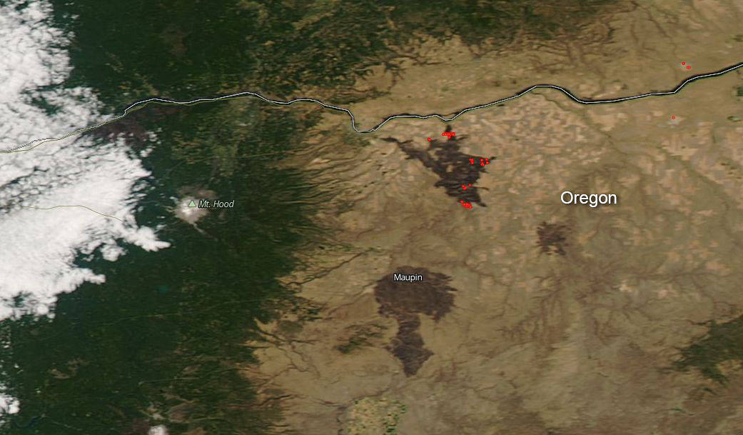
The Substation Fire started on private land southeast of The Dalles, Oregon on Tuesday, July 17, 2018 and grew quickly moving more than 18 miles in the first period of burning. Weather has played a major factor in the swift growth of the fire with gusy winds and uphill fire runs allowing the blaze to reach 70,421 acres. Crews did do a huge amount of work on Thursday with containment and that has now reached 15%. Handcrews, air resources, and heavy equipment continued working to slow the fire’s spread and reinforce containment lines, while engines and structural firefighters implemented tactics to protect structures. This weekend, significant winds are forecast and the hot, dry conditions will continue. Smoky conditions in the area are also of a concern to residents.
NASA’s Aqua satellite captured this image of the fire and smoke blowing from it on July 19, 2018, with the Moderate Resolution Imaging Spectroradiometer, MODIS, instrument. The dark red brown areas surrounding the actively burning areas are areas where the fire has burned through leaving raw, dark areas of burn scars in its wake. The red spots are actively burning areas detected by MODIS’s thermal bands and represent an area where the thermal detectors on the MODIS instrument recognized temperatures higher than background. Hot spots are diagnostic for fire. NASA image courtesy of the NASA/Goddard Space Flight Center Earth Science Data and Information System (ESDIS) project. Caption by Lynn Jenner with information from Inciweb.