


In discussing the fire weather outlook for the southeast United States, the Southern Area Coordination Center reported that: “Deep soil moisture and live fuel moisture dryness in southern Florida due to long-term drought conditions has created a fuel condition that supports fires of longer duration and more extreme fire behavior than would normally be expected.” In addition to that, “Based on current fuel conditions and forecasted weather conditions, the most likely scenario is an above average level of wildfire activity for February to May. This level of activity will likely cause some slight increase in firefighting resources being mobilized within a state. There is also a high probability the Southern Area will see higher than normal mobilization across state boundaries for this time of the year. It is also difficult to truly predict the overall wildfire risk as climate transitions from La Niña to neutral.”
The following is the current situation report from the Southern Area Coordination Center as of March 20, 2017:
- Total Initial Attack Fires and Acreage: 91 fires for 6,671 acres
- Ongoing Uncontained Large Fires and Active Acreage: 16 fires for 797,972 acres
- New Fires on Federal Protected Lands: 8 fires for 5,463 acres in AR, FL, NC and OK
- New Fires on State Protected Lands: 39 fires for 128 acres in FL and SC
- Other Initial Attack fires reported through other channels: 44 for 1,080 in AL, GA, MS and TX
- Prescribed Fire Activity: 57 fires for 3,485 acres in AL, AR, FL, and SC
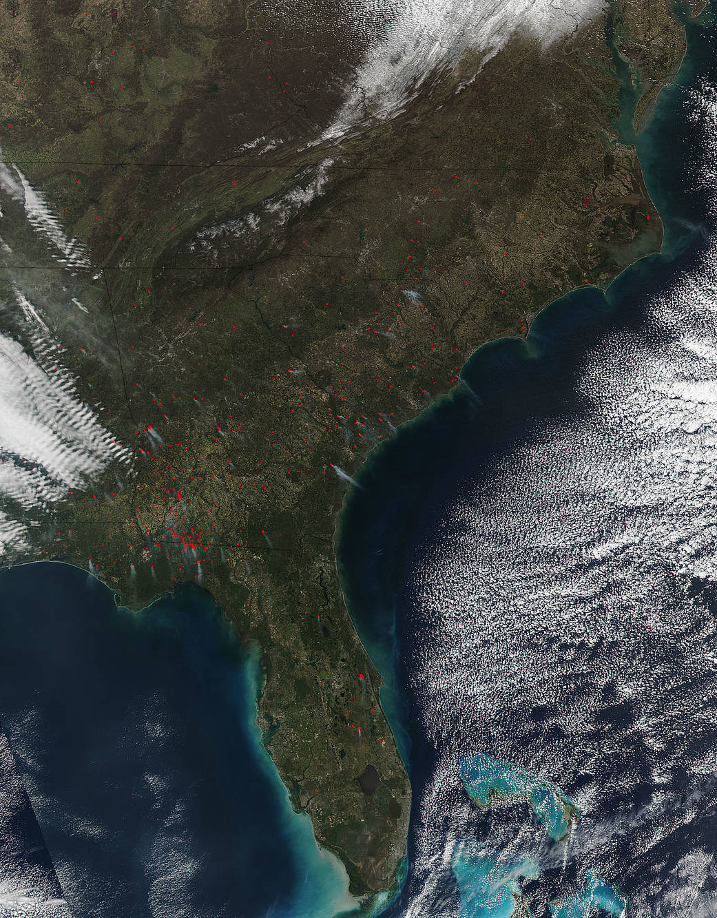
NASA’s Suomi NPP satellite collected this natural-color image using the VIIRS (Visible Infrared Imaging Radiometer Suite) instrument on March 16, 2017. Actively burning areas, detected by MODIS’s thermal bands, are outlined in red. The VIIRS instrument which collected this image is a 22-band radiometer which collects infrared and visible light data to observe weather, climate, oceans, nightlight, wildfires, movement of ice, and changes in vegetation and landforms. Suomi NPP is the first Earth-observing satellite to measure both global climate changes and key weather variables.
Suomi NPP is managed by NASA and NOAA. NASA image courtesy Jeff Schmaltz LANCE/EOSDIS MODIS Rapid Response Team, GSFC. Caption by Lynn Jenner