


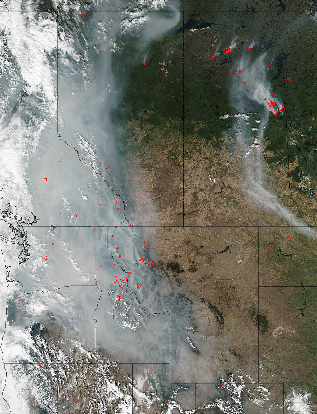
Wildfires have been widespread in the western United States and Canada this year. Not only does wildfire bring untold damage and destruction to the area it burns, the smoke that the fire releases creates its own health and pollution issues. In this image, it appears that most of the wildfire smoke is heading westward on winds that have changed direction from east to westbound. The Visible Infrared Imaging Radiometer Suite (VIIRS) instrument on the Suomi NPP satellite captured this look at multiple fires and smoke burning in several western states including California, Oregon, Washington, Idaho, and Montana, as well as British Columbia, Alberta, and Saskatchewan Provinces in Canada. Actively burning areas, detected by VIIRS are outlined in red.
The smoke released by any type of fire (forest, brush, crop, structure, tires, waste or wood burning) is a mixture of particles and chemicals produced by incomplete burning of carbon-containing materials. All smoke contains carbon monoxide, carbon dioxide, and particulate matter or soot and is hazardous to breathe. A Georgia Tech study released in 2017 also found that wildfire smoke spews methanol, benzene, ozone and other noxious chemicals. Residents in areas where smoke is present should check with local news agencies to keep informed of air quality indexes and precautions that can be followed during times of poor air quality.
NASA image courtesy Jeff Schmaltz, MODIS Rapid Response Team. Caption: NASA/Goddard, Lynn Jenner