


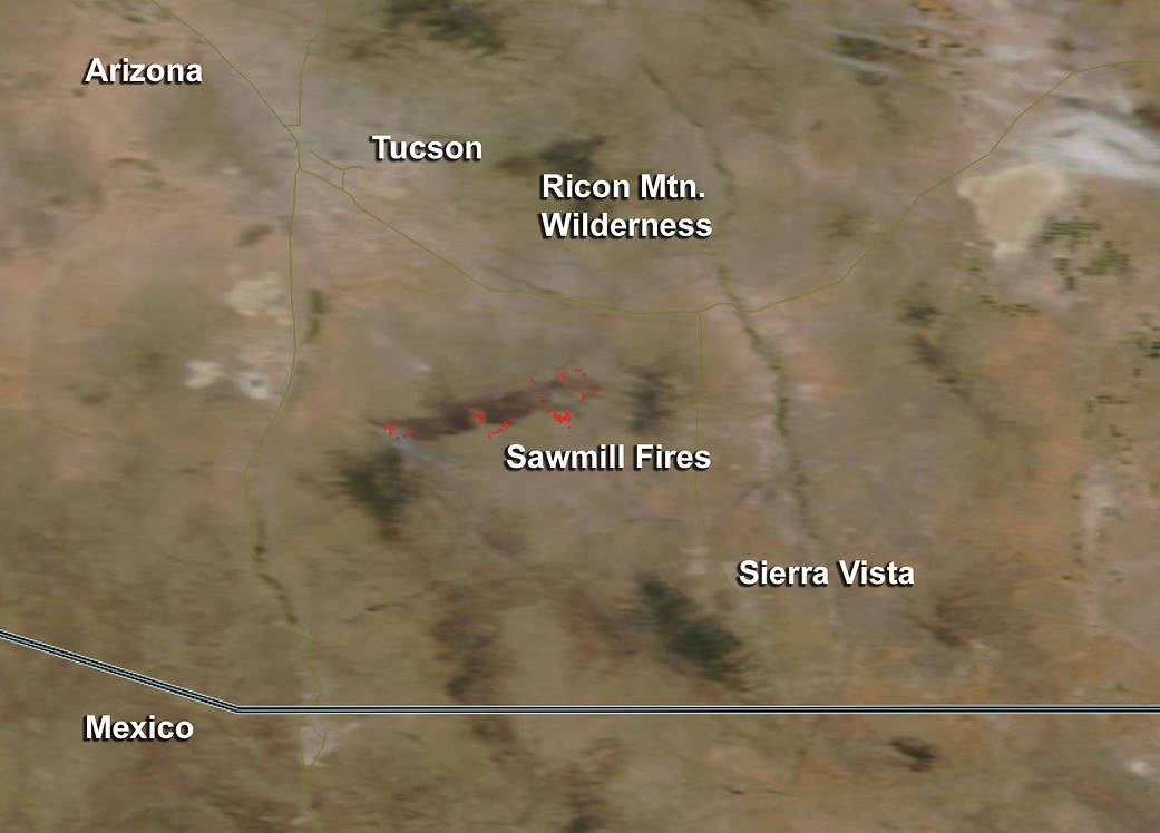
The heat from the Sawmill Fire in Arizona were detected by NASA’s Terra satellite as it passed overhead.
The Sawmill Fire is located 10 miles southeast of Green Valley, Arizona, which is southeast of Tucson, Arizona.
This natural-color satellite image was collected by the Moderate Resolution Imaging Spectroradiometer (MODIS) aboard the Terra satellite around 1:30 p.m. MDT on April 26, 2017. Actively burning areas, detected by MODIS’s thermal bands appear in red. Some light plumes of smoke surrounded what appeared to be a ring of fires.
Inciweb, an interagency all-risk incident information management system that coordinates with federal, state and local agencies to manage wildfires reported “The Sawmill Fire is burning on lands under the jurisdiction of Arizona Department of Forestry and Fire Management, Bureau of Land Management, and the Coronado National Forest.
Gusty winds and broken topography have contributed to growth of the fire, burning in tall grass, riparian woodland, mesquite/oak brush, oak woodland, and pinyon-juniper fuel types.”
As of April 27, 40,356 acres have burned and the fire is 20 percent contained. According to Inciweb, the fire began on Sunday April 23, 2017 at approximately 11 a.m. MDT.
Pre-evacuations and evacuations have occurred in several communities as there are ranches and outbuildings, homes, communications facilities, powerlines and the Arizona National Scenic Trail all at risk from this fire.
For updates from Inciweb, visit: https://inciweb.nwcg.gov/incident/5164/
NASA image courtesy Jeff Schmaltz, MODIS Rapid Response Team. Caption: NASA/Goddard, Rob Gutro with information from Inciweb.