


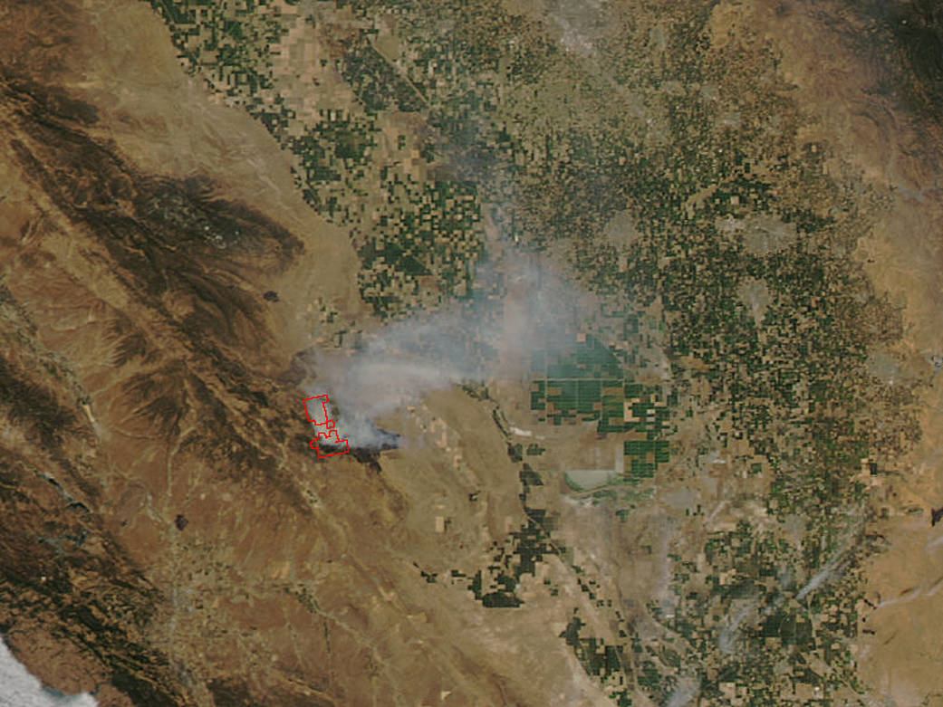
NASA’s Aqua satellite spotted smoke from the Garza Fire burning near the south central California town of Coalinga. Coalinga is located in Fresno County and the western San Joaquin Valley, about 66 miles southwest of Fresno.
This natural-color satellite image was collected by the Moderate Resolution Imaging Spectroradiometer (MODIS) instrument that flies aboard the Terra satellite. The image, taken at 5 p.m. EDT (2100 UTC) on July 13 and showed actively burning areas in red, as detected by MODIS’s thermal bands.
According to the CAL FIRE (California Fire) Fresno-Kings Unit, the fire began on July 9 around 3:10 p.m. PDT at Tar Canyon Road, near Avenal.
As of July 14 at 6:30 a.m. PDT, the fire has consumed 39,214 acres and is 43 percent contained. The update noted that the “fire is actively burning in tall grass and brush northwest of Tar Canyon, extending into Fresno County. Firefighters are working aggressively in steep and rugged areas with inaccessible terrain which is hindering firefighting efforts. A limited number of structures in remote areas continue to be threatened. Advisory evacuation warning in place west of Highway 33, north of the Fresno County line and south of Jacalitos Creek.”
NOAA’s National Weather Service July 14 forecast for the town of Coalinga included areas of smoke before 11 a.m. then sunny and hot, with a high near 102.
For updates on the Garza fire, visit: http://www.fire.ca.gov/current_incidents/incidentdetails/Index/1650
NASA image courtesy NASA MODIS Rapid Response Team. Caption: NASA/Goddard, Rob Gutro