


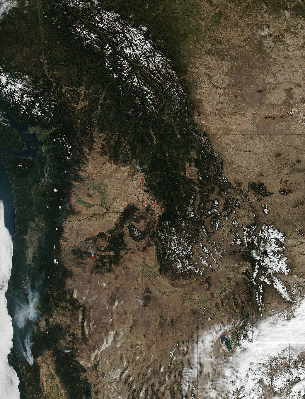
The Suomi NPP satellite’s Visible Infrared Imaging Radiometer Suite (VIIRS) instrument captured a look at multiple fires and smoke burning in the Pacific Northwest on September 28, 2017. Accompanying the fires are patches to snow already falling in the northern area. Actively burning areas, detected by VIIRS are outlined in red. Hot, dry conditions in the summertime make wildfires likely to plague the Pacific Northwest and California. This year, however, record-dry conditions, record breaking heat and a spate of lightning storms have made for a very dangerous fire season. As the summer wanes and the fall takes hold, cooler temperatures and snowfall should help to dampen the wildfire outbreaks in the area.
The Suomi NPP satellite is a joint mission between NOAA and NASA.
NASA image courtesy Jeff Schmaltz, MODIS Rapid Response Team. Caption: NASA/Goddard, Lynn Jenner