


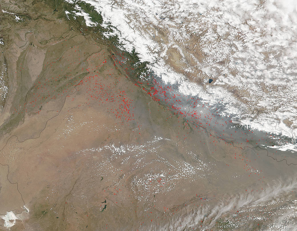
The Suomi NPP satellite captured this image of northern India and the fires and smoke that are sprinkled across the image.
Fires dot the landscape on the border of India (right) and Pakistan (left) at the foothills of the Himalaya Mountains. The fires are likely set for agricultural purposes. Farmers often use fire to return nutrients to the soil and to clear the ground of unwanted plants. While fire helps enhance crops and grasses for pasture, the fires also produce smoke that degrades air quality. NASA’s Suomi NPP satellite collected this natural-color image using the VIIRS (Visible Infrared Imaging Radiometer Suite) instrument on April 28, 2016. Actively burning areas, detected by thermal bands, are outlined in red. NASA image courtesy Jeff Schmaltz LANCE/EOSDIS MODIS Rapid Response Team, GSFC. Caption by Lynn Jenner