


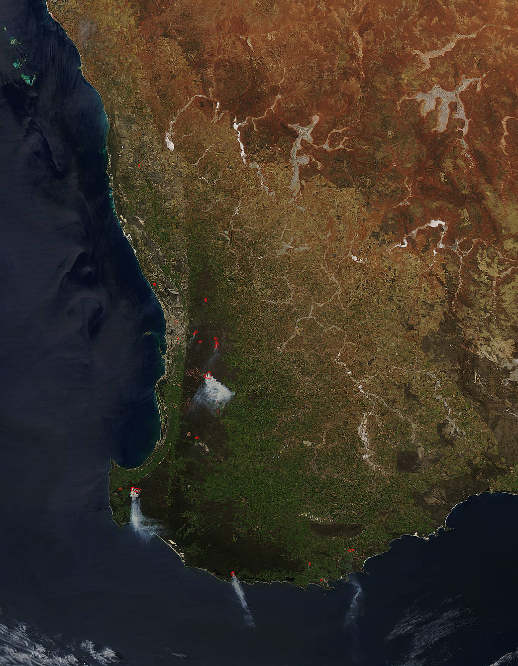
From the Western Australia Firewatch website, it appears the fires seen by NASA’s Aqua satellite in this image from October 12, 2016 are prescribed burns by the Western Australian government. These fires seen in this satellite image line up with the Prescribed Burn map found here: http://myfirewatch.landgate.wa.gov.au/alerts.html# These fires are prescribed burns that were set previously and are still active but are under the control of the Parks and Wildlife department.
Prescribed fires are set deliberately for a variety of reasons such as:
- Reducing hazardous fuels, protecting human communities from extreme fires;
- Minimizing the spread of pest insects and disease;
- Removing unwanted species that threaten species native to an ecosystem;
- Providing forage for game;
- Improving habitat for threatened and endangered species;
- Recycling nutrients back to the soil; and
- Promoting the growth of trees, wildflowers, and other plants;
Prescribed fires and even some wildfires benefit natural resources and reduce the risk of unwanted wildfires in the future. Hand tools and machines are also employed to thin overgrown sites in preparation for the eventual return of fire.
This natural-color satellite image was collected by the Moderate Resolution Imaging Spectroradiometer (MODIS) aboard the Aqua satellite. Actively burning areas, detected by MODIS’s thermal bands, are outlined in red. NASA image courtesy Jeff Schmaltz, MODIS Rapid Response Team. Caption: NASA/Goddard, Lynn Jenner with information from the Western Australia Firewatch website.