


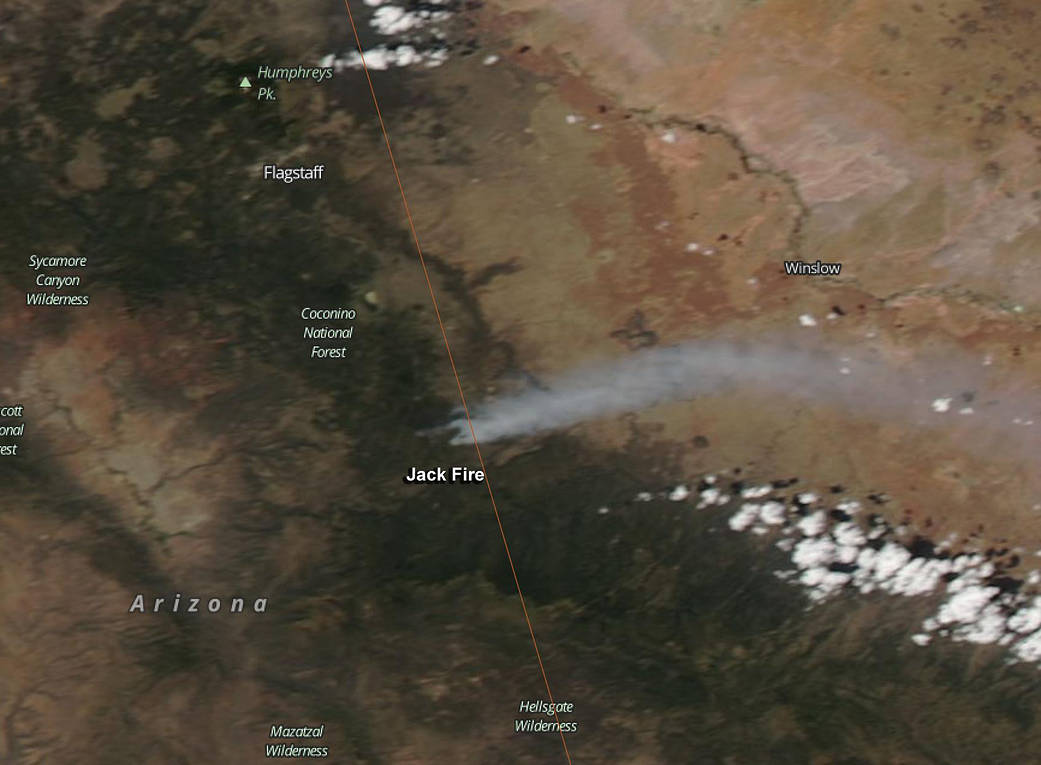
The Jack Fire in east-central Arizona continues to burn on June 10, and NASA’s Aqua satellite saw smoke streaming from the fire from its orbit in space.
The Moderate Resolution Imaging Spectroradiometer (MODIS) instrument that flies onboard NASA’s Aqua satellite captured an image of smoke from the Jack Fire on June 9, 2016. The multiple red pixels are heat signatures (red) detected by MODIS. The smoke appears to be a light brown color. That smoke was visible from Lake Mary Road as well as the communities of Clints Well, Happy Jack, Payson, Pine, Strawberry, the Verde Valley, the Heber area and Winslow.
The Jack Fire began as a lightning strike on May 29, 2016. It is located about 14 miles north of Clints Well, Arizona
It is also being treated as a prescribed burn. Fire managers with the Coconino National Forest are utilizing this recent lightning-caused fire to benefit the landscape and maintain a healthy ecosystem by allowing fire to fulfill its natural role in the environment.
As of June 8 at 4:47 p.m. MDT, Inciweb reported that the Jack Fire was 10,821 acres in size. InciWeb is an interagency all-risk incident information management system that coordinates with federal, state and local agencies to manage wildfires. For updates on all fires, visit the Inciweb website: http://inciweb.nwcg.gov.
NASA image courtesy Jeff Schmaltz LANCE/EOSDIS MODIS Rapid Response Team, GSFC. Caption by Rob Gutro with information from Inciweb.