


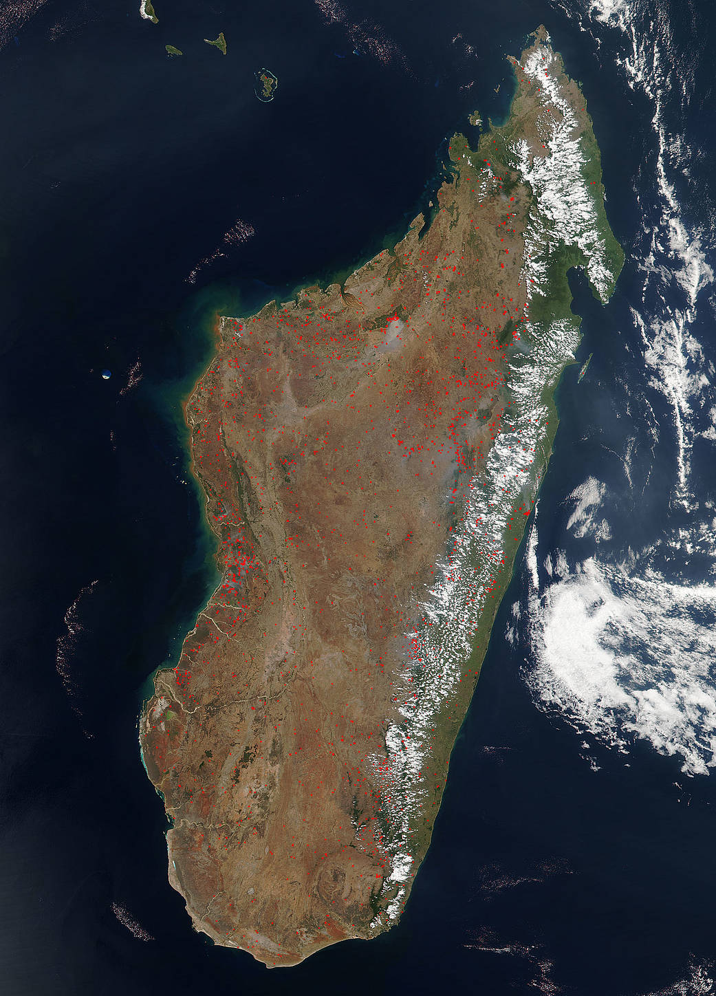
On October 07, 2016, hundreds of small fires burned across the Madagascar landscape. The Visible Infrared Imaging Radiometer Suite (VIIRS) on Suomi NPP captured a natural-color image of the island. Red boxes indicate locations where the sensor detected active fires.
The fires are scattered across the whole of the island with the largest grouping of fires appearing on the coastline. These fires are most likely intentional land-clearing or accidental human-caused fires. On Madagascar the primary use of fire is for pasture management. The burning of grasslands prevents woody plants (which cattle do not eat) from encroaching on the cattle’s pastureland. Fire is also used to clear brush and detritus for agricultural farming. Although these fires while in control are immediately dangerous, agricultural fires have a significant impact on climate and air quality, and there is always a chance these fires could potentially grow uncontrolled.
NASA image courtesy Jeff Schmaltz, LANCE MODIS Rapid Response Team at NASA GSFC, using VIIRS data from the Suomi National Polar-orbiting Partnership (Suomi NPP). Suomi NPP is the result of a partnership between NASA, the National Oceanic and Atmospheric Administration, and the Department of Defense. Caption by Lynn Jenner with information from the Earth Observatory.