


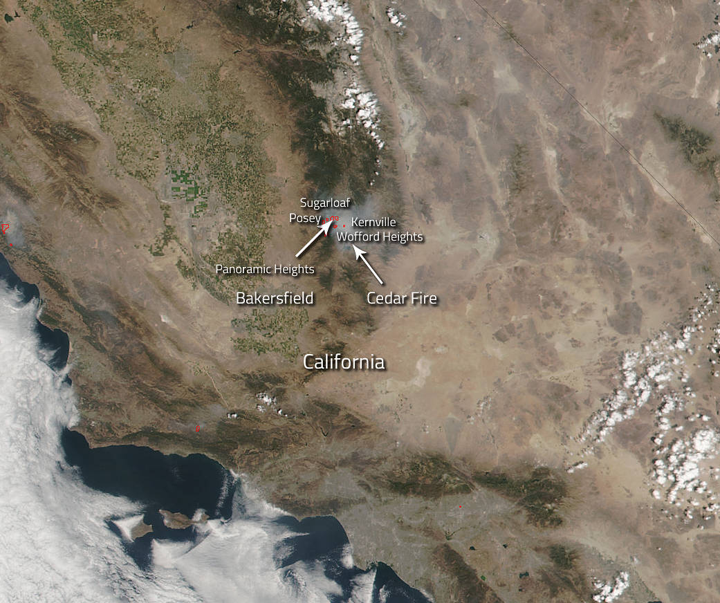
The Cedar Fire located 5 miles east of Glennville has been blazing since August 16, 2016, and the cause of this fire remains under investigation. Currently 27,586 acres have burned and over 2,300 personnel are fighting this fire. On August 25, fire crews were busy in the Panorama Heights and Sugarloaf areas. The firing operation continued through the night to protect homes in the area. Two night-flying capable helicopters that dropped buckets of water to manage the fire’s movement and to support crews on the ground.
Due to unsatisfactory weather conditions the fire is expected to grow on the north, east and west flanks. The communities of Posey, Sugarloaf, and Panoramic Heights will continue to be threatened on the West side of the fire and these areas remain under a mandatory evacuation. The fire is expected to become well established in Stormy Canyon on the east side of the fire. Kernville and Wofford Heights are in a precautionary evacuation status.
Little change in temperature and relative humidity is forecast as a large dry air mass remains over the region. Light southeast ridge winds in the morning are expected to shift to the southwest and then west during mid to late afternoon. Terrain-driven winds will prevail with gusty conditions in the Kern River Canyon. These conditions will last through the weekend, trending a little warmer and drier into early next week.
NASA’s Suomi NPP satellite captured this visible light image of the area where the Cedar Fire is burning. The Visible Infrared Imaging Radiometer Suite (VIIRS) instrument on the satellite collected this image on August 25, 2016 at 5:25 pm EDT (2125 UTC). Actively burning areas, detected by MODIS’s thermal bands, are outlined in red. The Suomi NPP satellite is a joint mission between NASA, NOAA and the U.S. Department of Defense.
NASA image courtesy Jeff Schmaltz LANCE/EOSDIS MODIS Rapid Response Team, GSFC. Caption by Lynn Jenner with information from Inciweb.