


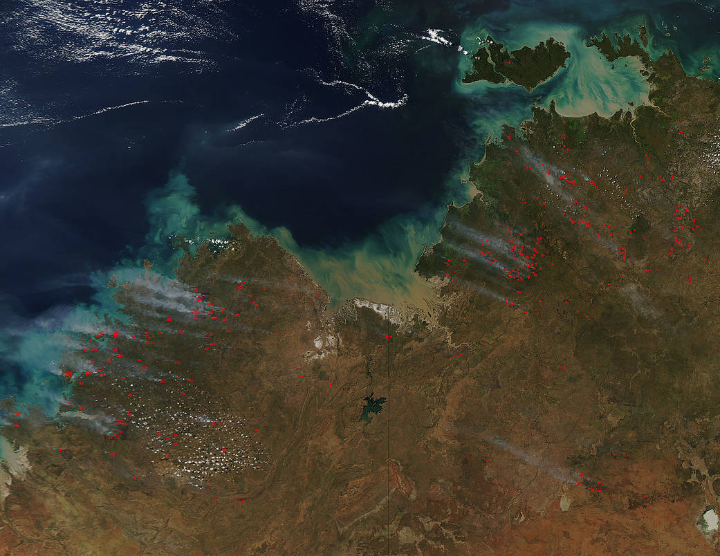
This natural-color satellite image of northern Australia was collected by the Moderate Resolution Imaging Spectroradiometer (MODIS) aboard the Aqua satellite on April 24, 2016. The Department of Fire and Emergency Services website in Western Australia is not currently issuing any fire warnings (as of May 02, 2016) which means the hot spots that are seen on this satellite image are not affecting any persons or buildings, and are relatively small in nature and may even be prescribed burns set on purpose by fire officials to clear overgrowth. The Fire Weather Forecast Summary from the Australian Government’s Bureau of Meteorology (May 02, 2016) website provides information on the many fires in the Northwest Territory. Most fires seem to be grass fires, but none seem to be overly large or out of control. Fire danger is listed as low to moderate throughout the territory. Actively burning areas, detected by MODIS’s thermal bands, are outlined in red.
NASA image courtesy Jeff Schmaltz, MODIS Rapid Response Team. Caption: NASA/Goddard, Lynn Jenner