


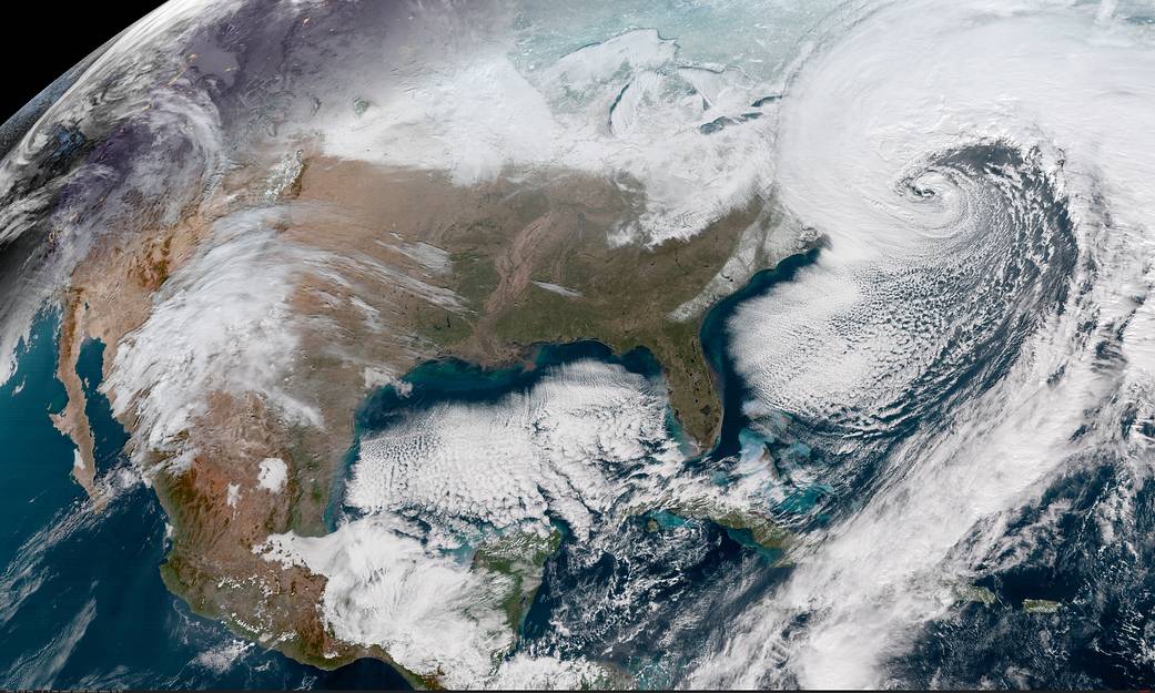
This Geocolor image from the National Oceanic and Atmospheric Administration (NOAA) GOES-16 satellite captures the deepening storm off the East coast of the United States on Jan. 4, 2018, at 16:22 UTC. The powerful nor’easter is battering coastal areas with heavy snow and strong winds, from Florida to Maine. Notice the long line of clouds stretching over a thousand miles south of the storm, which is drawing moisture all the way from deep in the Caribbean.
Geocolor is a multispectral product composed of True Color (using a simulated green component) during the daytime, and an Infrared product that uses bands 7 and 13 at night. During the day, the imagery looks approximately as it would appear when viewed with human eyes from space.
The Geostationary Operational Environmental Satellite (GOES) – R Series is a collaborative development and acquisition effort between NOAA and NASA. The GOES-16 (GOES-East) satellite, the first of the series, provides continuous imagery and atmospheric measurements of Earth’s western hemisphere and space weather monitoring.