


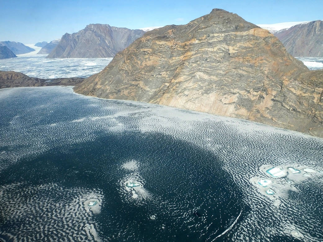
On May 19, 2016, NASA’s IceBridge, an airborne survey of polar ice, crossed Greenland to fly central glacier flowlines in the east-central region of the country. This photo captures the fjord of Violin Glacier, with Nord Glacier at the upper left corner.
This year marks IceBridge’s eighth spring campaign of science flights over Arctic sea and land. During the seven previous years of operations in the Arctic, IceBridge has gathered large volumes of data on changes in the elevation of the ice sheet and its internal structure. Measurements from IceBridge have revealed a 460-mile-long (740 kilometers) canyon hiding under a mile of ice and mapped the extent of a vast liquid water aquifer beneath the snow in southern Greenland. IceBridge’s readings of the thickness of sea ice and its snow cover have helped scientists improve forecasts for the summer melt season and have enhanced the understanding of variations in ice thickness distribution from year to year.
Image Credit: NASA/Maria José Viñas