


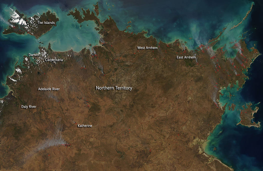
From the Australian Government’s Bureau of Meteorology comes this weather forecast and fire danger prediction: “Mostly sunny apart from a slight chance of showers about the northeast coast. Moderate east to southeast winds, tending fresh and gusty at times over central and northern parts during the day. The combination of low humidity and gusty southeasterly winds are expected to peak today, causing Extreme fire danger over the Darwin and Adelaide River District. With similar dry and gusty conditions over much of the northern half of the Territory, Severe fire danger conditions are expected for the Northern Fire Protection Area, Daly South, Tiwi, Arnhem West, Katherine Fire Protection Area and Carpentaria East and West Districts. High to Very High fire danger elsewhere north of Tennant Creek.” Tennant Creek is not seen in this satellite image but it is located south of the area being shown meaning everything to the north is under High to Very High fire danger according to reports.
This natural-color satellite image was collected by the Moderate Resolution Imaging Spectroradiometer (MODIS) aboard the Aqua satellite on September 06, 2015. Actively burning areas, detected by MODIS’s thermal bands, are outlined in red and these fires tend to run along the areas that were outlined in the fire forecast above. Australian fire maps show these fires began within the last 72 hours.
NASA image courtesy Jeff Schmaltz, MODIS Rapid Response Team. Caption: NASA/Goddard, Lynn Jenner