


NASA Celebrates Contributions to 40 Years of NOAA GOES Satellites
NOAA is celebrating 40 years of operating GOES (Geostationary Operational Environmental Satellites). NASA has been an integral part of the development and launch of the GOES.
The GOES program formally began in 1975 as a joint effort of NOAA and NASA. The GOES series of U.S. satellites are developed by a joint NASA-NOAA-Industry partnership, launched by NASA (with industry partners), and operated by NOAA.
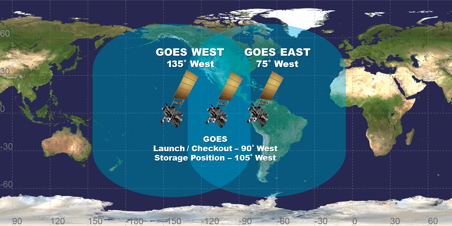
Geostationary means the satellite is always in the same position with respect to the rotating Earth allows it to hover over one position on the Earth’s surface. NOAA operates a GOES-East satellite and a GOES-West satellite to provide constant vigil for the atmospheric “triggers” for severe weather conditions such as tornadoes, flash floods, hail storms, and hurricanes. GOES-West covers the western U.S. and the Central and Eastern Pacific Ocean. GOES-East covers the eastern U.S. and the Atlantic Ocean.
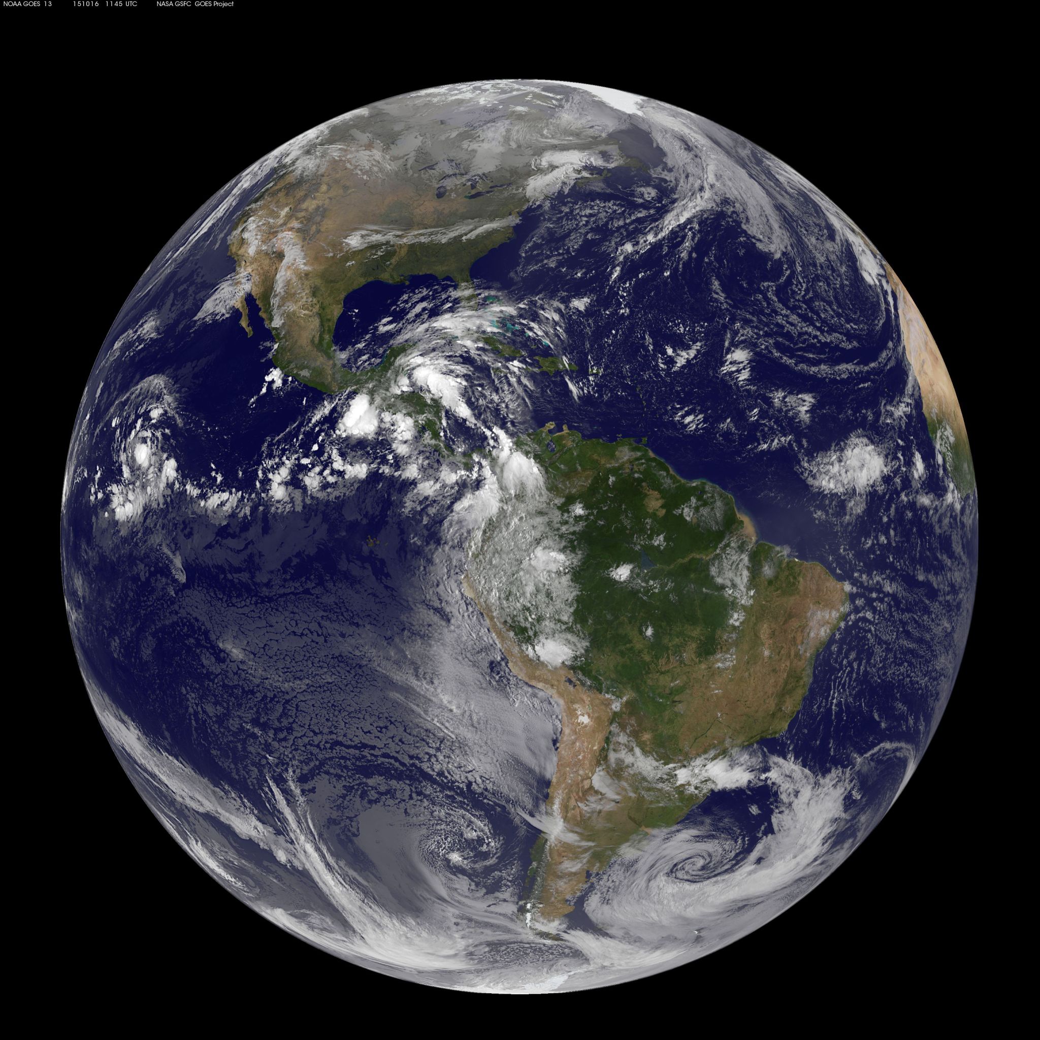
The NASA/NOAA GOES Project Science Team at NASA’s Goddard Space Flight Center creates infrared and visible images and animations from the GOES-East and GOES-West satellites. Imagery can be found at: http://goes.gsfc.nasa.gov/.
“There were several major historical GOES-support efforts by NASA,” said Dr. Dennis Chesters of the NASA/NOAA GOES Project at NASA’s Goddard Space Flight Center, Greenbelt, Maryland. “The VAS Demonstration, a NASA funded weather research program ran from 1974 to 1983 to develop a prototype ground station, data processing system, and meteorological product evaluation for the VISSR Atmospheric Sounder on GOES-4/5/6. In addition, the Search And Rescue (SAR) Lab, a NASA funded radio engineering lab at Goddard in the 1980’s to evaluate and perfect the SAR system on GOES-4/5/6.”
A ground station hosted at NASA Goddard was installed after a hurricane brushed Wallops to provide a storm-safe backup. The Goddard station, known as the Wallops Backup (WBU) is capable of operating one GOES satellite, specifically the GOES East satellite operating over the Atlantic Ocean. The station at Wallops acquires and distributes a continuous flow of data from NOAA’s GOES to users around the country. A new 54-foot antenna, weighing more than a million pounds, is designed to operate through a Category 3 hurricane (130 mph); and can survive a Category 5 hurricane (155+ mph). The antenna has transmitters for sending commands to the satellites, and receivers for collecting information from the satellites.
On October 16, 1975, the first satellite under the GOES program was launched from Cape Canaveral, Florida. 2015 marks the 40th anniversary of the launch of the first GOES satellite. GOES-A was renamed GOES-I once it reached orbit. GOES-2 and GOES-3 followed in 1977 and 1978.
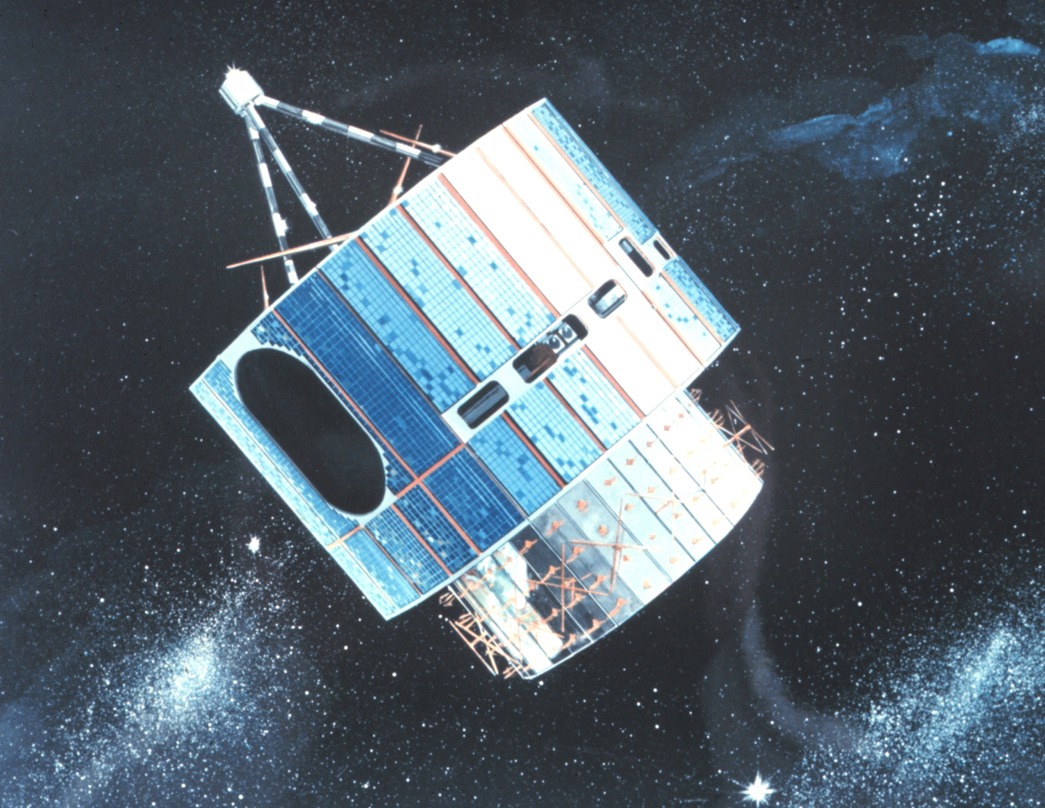
GOES 4-7 were designed similar to the first three GOES satellites. GOES-4 was launched on September 9, 1980. It was the first satellite to carry the Visible Infrared Spin Scan Radiometer (VISSR) Atmospheric Sounder (VAS), enabling the measurement of temperature and moisture.
On May 3, 1986, GOES-G, was lost when its launch vehicle was struck by lightning shortly after lift-off. GOES-G, which would have been GOES-7, was designed to replace GOES-4.
GOES-7 was launched on April 28, 1987. This satellite was the first GOES satellite capable of detecting 406 MHz distress signals from emergency beacons carried aboard aircraft and vessels and sending them to ground stations. This was the last of the spin-stabilized geosynchronous satellites.
The launch of GOES-8 on April 13, 1994 introduced a new generation of spacecraft, the GOES I-M series. The three-axis, body-stabilized design provided significant improvements. The imager and the sounder were separate instruments and operated independently, which enabled the satellites to continuously obtain both imaging and sounding data instead of alternating between the two operating modes. The satellites were also capable of capturing higher resolution images. Starting with GOES-8, the GOES search and rescue system became operational. The Earth-pointing radiometers on GOES-8/15 included an Imager and Sounder.
On July 23, 2001, GOES-12 (GOES-M), the last satellite of the GOES I-M series, was launched from Cape Canaveral, FL. It was the first satellite to carry a Solar X-Ray Imager (SXI) instrument.
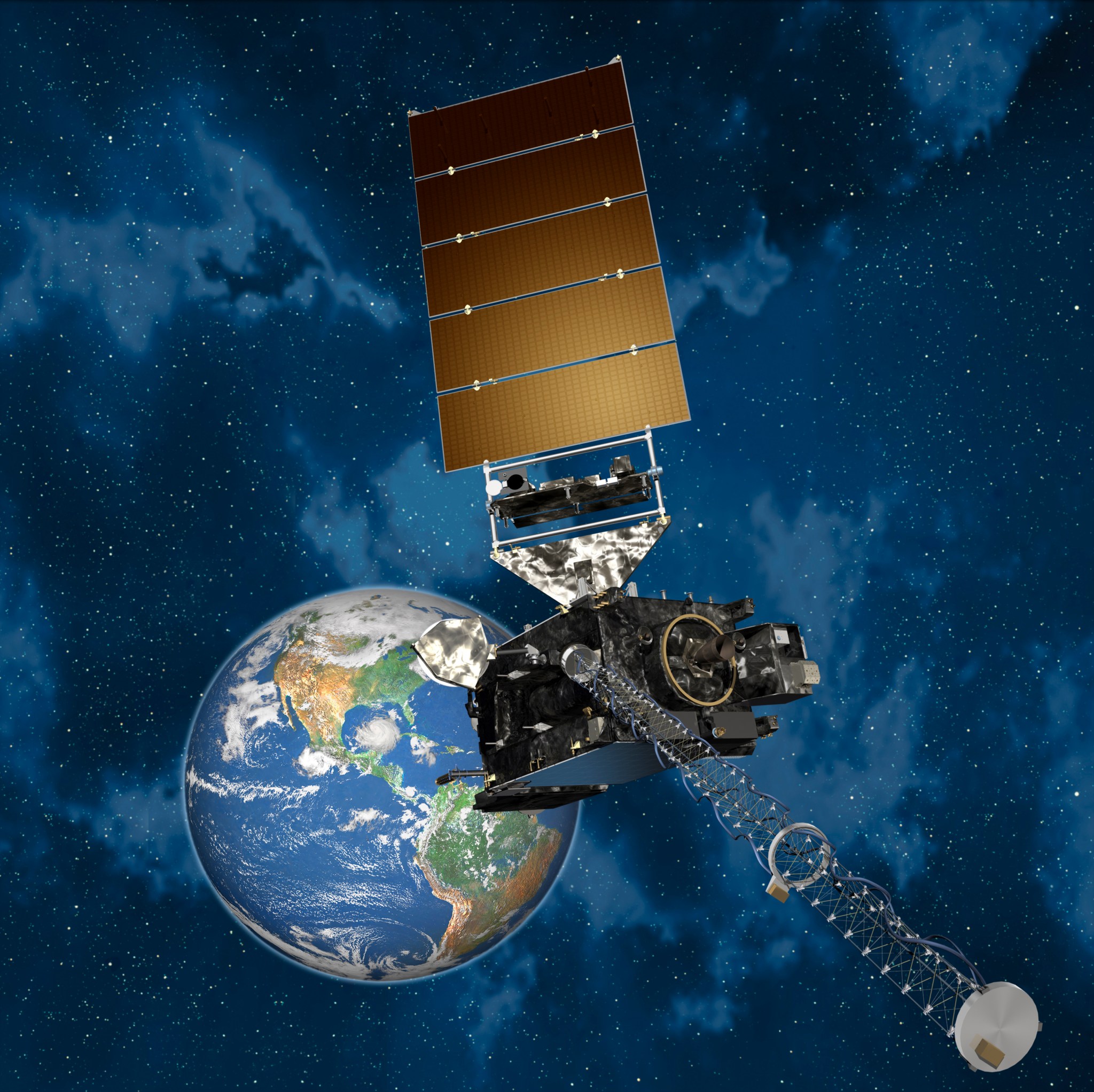
The multi-mission GOES N series (13 through 15 or GOES-N, GOES-O and GOES-P) became vital contributors to weather, solar and space operations, and science. NASA and NOAA are actively engaged in a cooperative program to expand the existing GOES system. The series introduced several improvements over previous GOES spacecraft, including highly advanced attitude control system fostering enhanced instrument performance for improved weather service quality. NASA and NOAA set a high standard of accuracy for the series, including data pixel location to two kilometers from geosynchronous orbit, or 22,240 miles above the surface of the Earth.
The GOES-R series (GOES-R, GOES-S, GOES-T and GOES-U) is the next generation of geostationary Earth-observing satellites. GOES-R, the first satellite in the series is planned for launch in 2016. The GOES-R series will provide continuous imagery and atmospheric measurements of Earth’s Western Hemisphere. The satellites will offer advanced imaging with increased spatial resolution and faster coverage for more accurate forecasts, real-time mapping of lightning activity, and improved monitoring of solar activity. GOES-R products will improve hurricane tracking and intensity forecasts, increase thunderstorm and tornado warning lead time, improve aviation flight route planning, better monitor areas of smoke and dust, improve air quality warnings and alerts, improve solar flare warnings for communications and navigation disruptions, and enhance space weather monitoring.
The GOES-R Series Program is managed with an integrated NOAA-NASA program office organization, staffed with personnel from NOAA and NASA, and supported by industry contractors. The Program is co-located at NASA’s Goddard Space Flight Center in Greenbelt, Maryland, and is composed of the GOES-R Program Office and two integrated NOAA-NASA project offices: the Flight Project and the Ground Segment Project. The Flight Project oversees the development of the space segment, which consists of the spacecraft, the instruments, launch vehicle, and the auxiliary communication payloads. The Ground Segment Project consists of the facilities, antenna sites, and the software and hardware for satellite command and control and to process, create, and distribute end user products.
The GOES system currently consists of GOES-13 operating as GOES-East in the eastern part of the constellation and GOES-15, operating as GOES-West. The GOES-R series will maintain the 2-satellite system implemented by the current GOES series. The GOES-R series operational lifetime extends through December 2036.
For more information about the NASA Wallops WBU, visit: http://www.noaanews.noaa.gov/stories/s500.htm
Learn more at www.goes-r.gov or https://www.nasa.gov/goes
For imagery and video from NASA/NOAA’s GOES Project: http://goes.gsfc.nasa.gov/