NASA is developing capabilities that will allow missions at high altitudes to take advantage of signals from Global Navigation Satellite System (GNSS) constellations — like GPS commonly used in the U.S. These signals — used on Earth for navigation and critical timing applications — could provide NASA’s Artemis missions to the Moon with reliable timing and navigation data. NASA’s Space Communications and Navigation (SCaN) program is developing the technologies that will support this goal.
Interoperability of the GNSS constellations will be key to realizing this ambition. There are six GNSS constellations that provide Position, Navigation, and Timing (PNT) services, each hailing from different countries worldwide. Four constellations, those operated by the U.S., the European Union, Russia, and China, provide global coverage. The other two, operated by India and Japan, provide regional coverage.
Using multiple constellations at once offers more signal availability, which can mean improved accuracy in navigation and timing for satellites. This could be especially helpful for spacecraft at higher altitudes where GNSS signals are less plentiful overall.
However, each constellation has unique designs. This poses a challenge to engineers hoping to develop multi-GNSS systems that take advantage of multiple constellations.
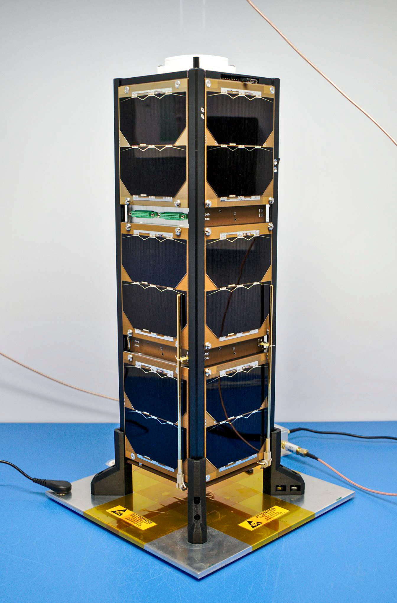
Bobcat-1
SCaN is supporting a number of flight experiments that will help develop multi-GNSS capabilities for spacecraft. Bobcat-1, developed by NASA’s Glenn Research Center in Cleveland and Ohio University, is one such example.
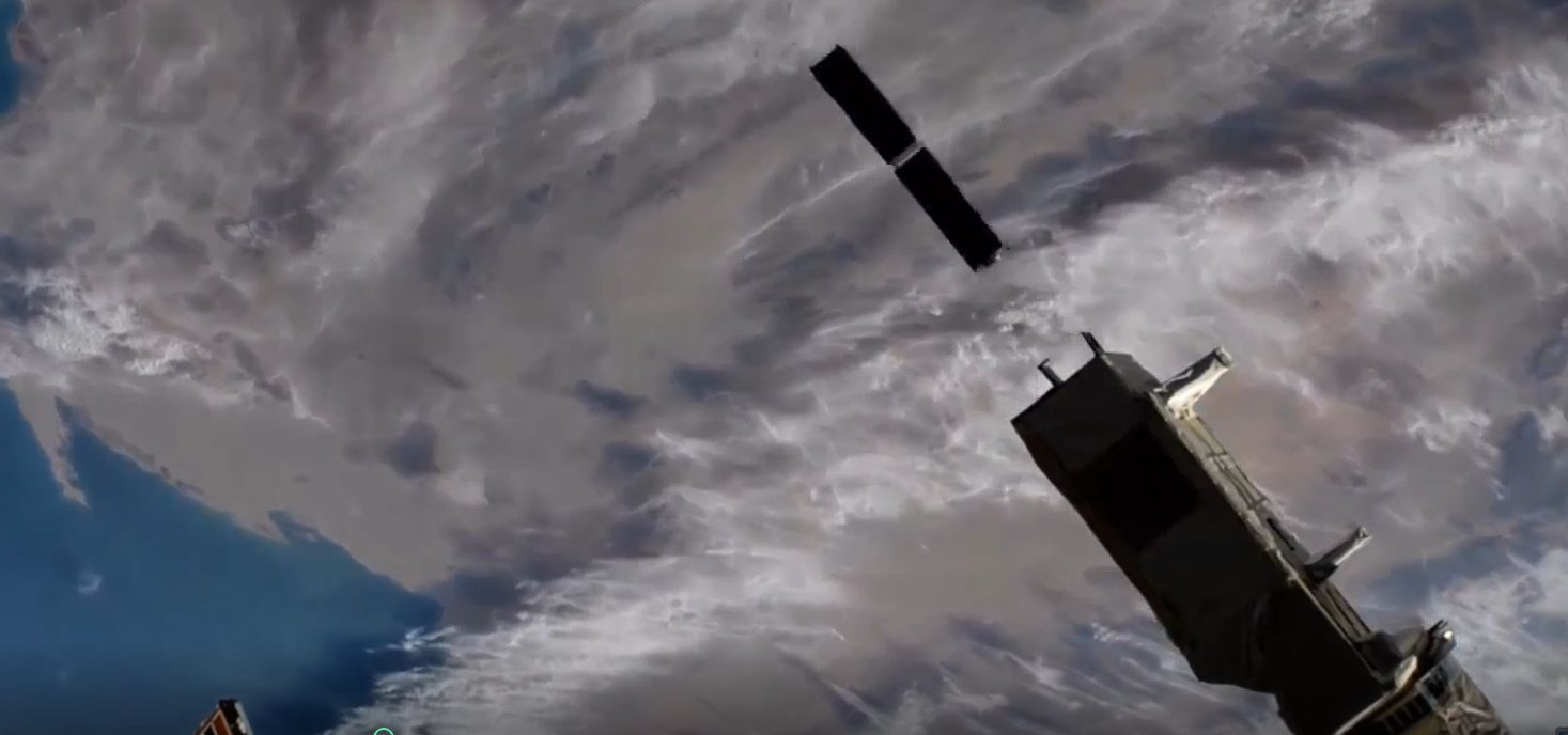
Bobcat-1 was selected by the CubeSat Launch Initiative in 2018 to study GNSS signals from 250 miles overhead. The small satellite launched to the International Space Station aboard a Northrop Grumman Cygnus spacecraft on Oct. 2, 2020.
On Nov. 5, the space station released the CubeSat to begin its mission. The spacecraft will orbit for about nine months, measuring signals from different GNSS constellations. Engineers will use these measurements to better understand GNSS performance, specifically focusing on timekeeping variations between the constellations.
“GNSS users at high altitudes see fewer satellites. Time offsets between the constellations can be measured by the CubeSat and provided to these users to improve their positioning performance,” said Bobcat Co-Principal Investigator Frank Van Grass of Ohio University.
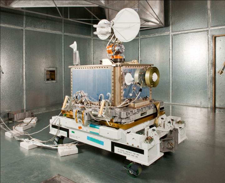
The SCaN Testbed
Bobcat-1 builds on the legacy of the SCaN Testbed, which demonstrated multi-GNSS capabilities on the space station from 2012 to 2019. The GPS and Galileo Receiver for the International Space Station (GARISS) — an instrument developed in collaboration between NASA and ESA (European Space Agency) — received signals from both GPS and Galileo, the GNSS constellation operated by the European Union.
The SCaN TestBed also laid the foundation for the Lunar GNSS Receiver Experiment (LuGRE), a Commercial Lunar Payload Services payload being developed in partnership with the Italian Space Agency. The payload will receive signals from both GPS and Galileo and is expected to obtain the first-ever GNSS fix on the lunar surface.
GNSS PNT Policy and Advocacy
While NASA engineers develop the technologies necessary for multi-GNSS navigation at ever-higher altitudes, the SCaN team works with stakeholders in the U.S. government and internationally to advance GNSS interoperability in the policy sphere. They consult on the United Nations International Committee on GNSS, helping develop additional capabilities in the Space Service Volume and beyond.
NASA recently worked to publish GPS antenna patterns from GPS satellites that launched between 1997 and 2000, collaborating with the U.S. Space Force, the U.S. Coast Guard, and Lockheed Martin, who built the satellites. The PNT team is also working to facilitate publication of antenna patterns for more recent GPS satellites. With this data, mission planners can better assess the performance of GNSS in high-Earth orbit and lunar space. This forthrightness also encourages other GNSS providers to be similarly transparent.
“GNSS capabilities continue to revolutionize the ways spacecraft navigate in near-Earth space and beyond,” said NASA navigation engineer Joel Parker. “NASA’s longstanding relationships with the GNSS providers have advanced these capabilities to new heights and support the Artemis missions on and around the Moon.”