Satellites Show Short-lived Depression 4W Dissipating
Tropical Cyclone 4W developed in the Northwestern Pacific on May 12, 2018, and by May 14 the storm had dissipated. Visible and infrared satellite imagery showed the decaying storm.
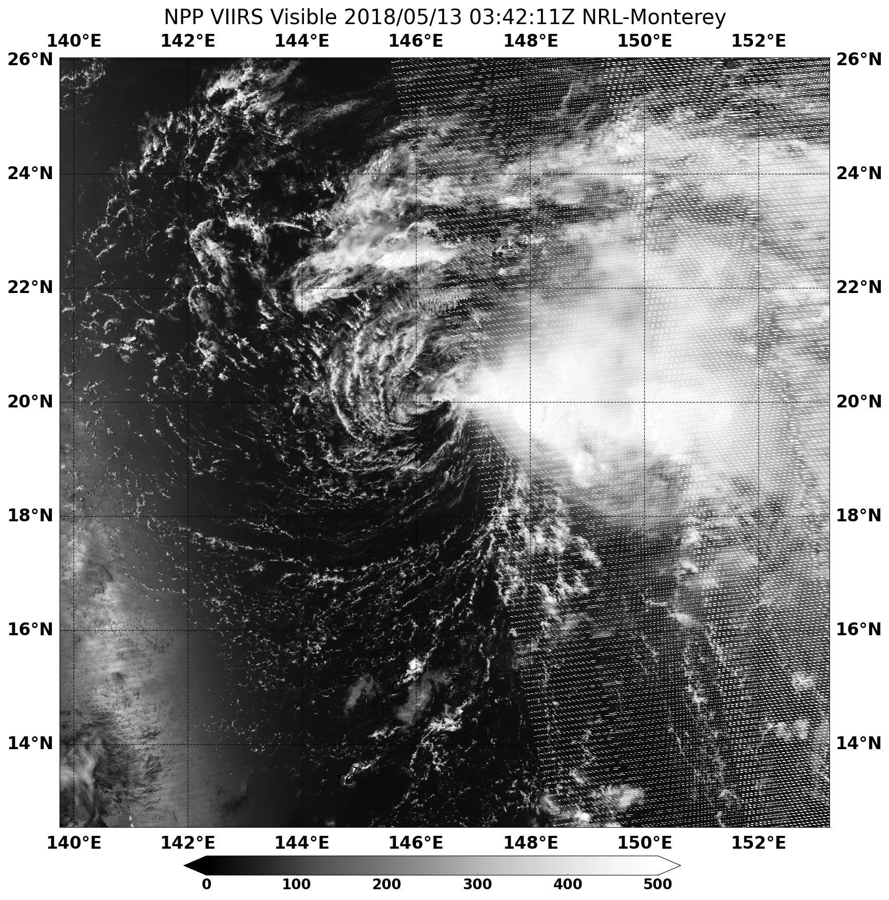
On May 13, NASA –NOAA’s Suomi NPP satellite captured a visible image of the storm that showed wind shear had pushed to the bulk of clouds east of the low-level center of circulation. As a result of the wind shear, the storm continued to weaken.
On May 14 at 5 p.m. EDT, The Joint Typhoon Warning sensor issue their final warning on the system. At that time it was located at 20.6 degrees north latitude and 144.4 degrees east longitude. That made the center approximately 131 nautical miles northwest of Agrihan. It was moving to the west-northwest at 6 knots and had a maximum sustained winds of 28 mph (25 knots).
Tropical Cyclone 4W is expected to dissipate by the end of May 14.
By Rob Gutro
NASA’s Goddard Space Flight Center, Greenbelt, Md.