


A satellite view of the U.S. on Dec. 22 revealed holiday travelers on both coasts are running into wet weather. A visible image from NOAA’s GOES-16 satellite showed systems affecting the Pacific Northwest, the Ohio and Tennessee Valleys and the areas from the southeastern U.S. to the Mid-Atlantic.
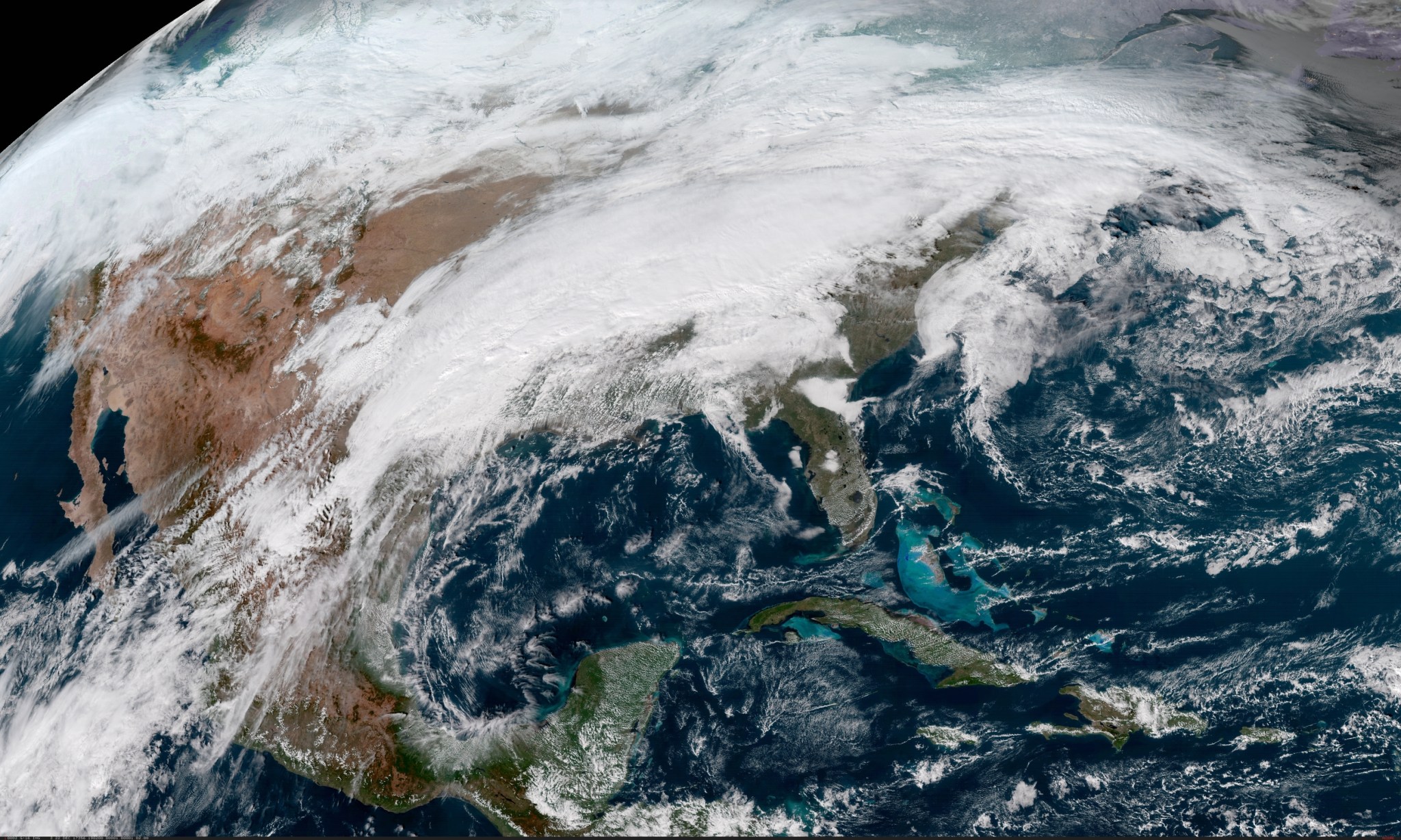
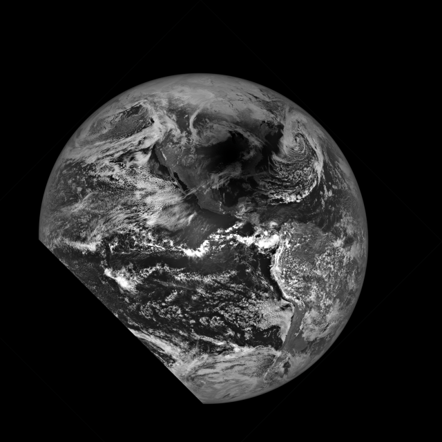
NOAA’s GOES-East satellite provides infrared and visible data of the eastern half of the U.S. In a visible image taken on Friday, Dec. 22 at 1902 UTC (2:02 p.m. EST) from NOAA’s GOES-16 satellite, now known as the GOES-East satellite, a large area of clouds associated with a frontal system stretched from Texas through the Ohio Valley into New England bringing rain with it. The system was also bringing snow to parts of Maine. The front will push off the Atlantic coast by Sunday, Dec. 24 and behind it a second cold front is forecast to move into the region.
In the Pacific Northwest, clouds seen in the GOES-East satellite image are associated with two low pressure areas, one just west of Washington State and the other over Idaho. The National Weather Service said “A frontal zone dropping through the Intermountain West along with a wave of low pressure approaching from the Pacific will promote coastal rains for Washington, Oregon, and eventually northwest California with areas of snow across the Cascades and Interior Northwest as well as the northern / central Rockies over the next couple of days.”
Parts of northern Minnesota, Michigan’s Upper Peninsula and northern Michigan are also forecast to receive some snow on Dec. 22.
The National Weather Service (NWS) Weather Prediction Center noted that weekend holiday travelers can expect “possible heavy rainfall and flooding across the lower Mississippi and Tennessee Valleys into early Saturday, Dec. 23. Snow and ice will overtake much of the Great Lakes and Northeast, while arctic air moves into the northern Plains.
It will really feel like winter by Dec. 24 as Arctic air is forecast to surge southward along the Northern Rockies and into the Northern Plains in the wake of the cold front moving through the Southeast and a secondary boundary dropping into the northern Plains.
NWS said “Temperatures across this sector will plummet into the teens above zero, which on average will be 20 degrees below normal for late December, though no record lows or record cold high temperatures are anticipated until at least Monday, Dec. 25.
Meanwhile, low humidity and offshore winds will continue to result in elevated-to-critical fire weather conditions across southern California through at least Christmas Day.”
For updated forecasts, visit the NWS website: www.weather.gov
By Rob Gutro
NASA’s Goddard Space Flight Center