


Satellite Shows Pilar Reduced to Remnants
Tropical Depression Pilar weakened to a remnant low pressure area as it continued to crawl north along the west coast of Mexico. Satellite data revealed no circulation center.
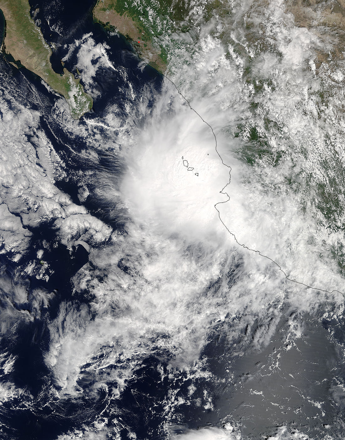
NOAA’s GOES West satellite provided an infrared image of Mexico’s west coast on Sept. 26 at 7:45 a.m. (1145 UTC). The image showed disorganized clouds south of Baja California. The infrared image makes the clouds appear transparent in the image.
NOAA manages the GOES series of satellites and the NASA/NOAA GOES Project at NASA’s Goddard Space Flight Center in Greenbelt Md. uses the data to produce images and animations.
On Tues. Sept. 26 at 2:35 a.m. EDT (0635 UTC), the National Hurricane Center noted that the remnants of Tropical Depression Pilar were in the form of a small cluster of weak convection, located about halfway between Mazatlan and Culiacan Mexico near 24 degrees north latitude and 107 degrees west longitude.
NHC noted that a residual, elongated area of low pressure lingering in the wake of Pilar extends from near Cabo San Lucas in Baja California Sur to near Mazatlan Sinaloa. Winds in the area are estimated near 15 knots or less and seas were between 4 and 6 feet near the mouth of the Gulf of California.
NHC’s discussion stated that “low level moisture still pooling along the western slopes of the Sierra Madre Occidental and the coastal zones from Guadalajara to central Sinaloa on Sept. 27 are expected to produce scattered showers and thunderstorms, some yielding very heavy rain.”
By Rob Gutro
NASA’s Goddard Space Flight Center
Sep. 25, 2017 – NASA Catches Tropical Depression Pilar Hugging and Soaking Mexico’s Coast
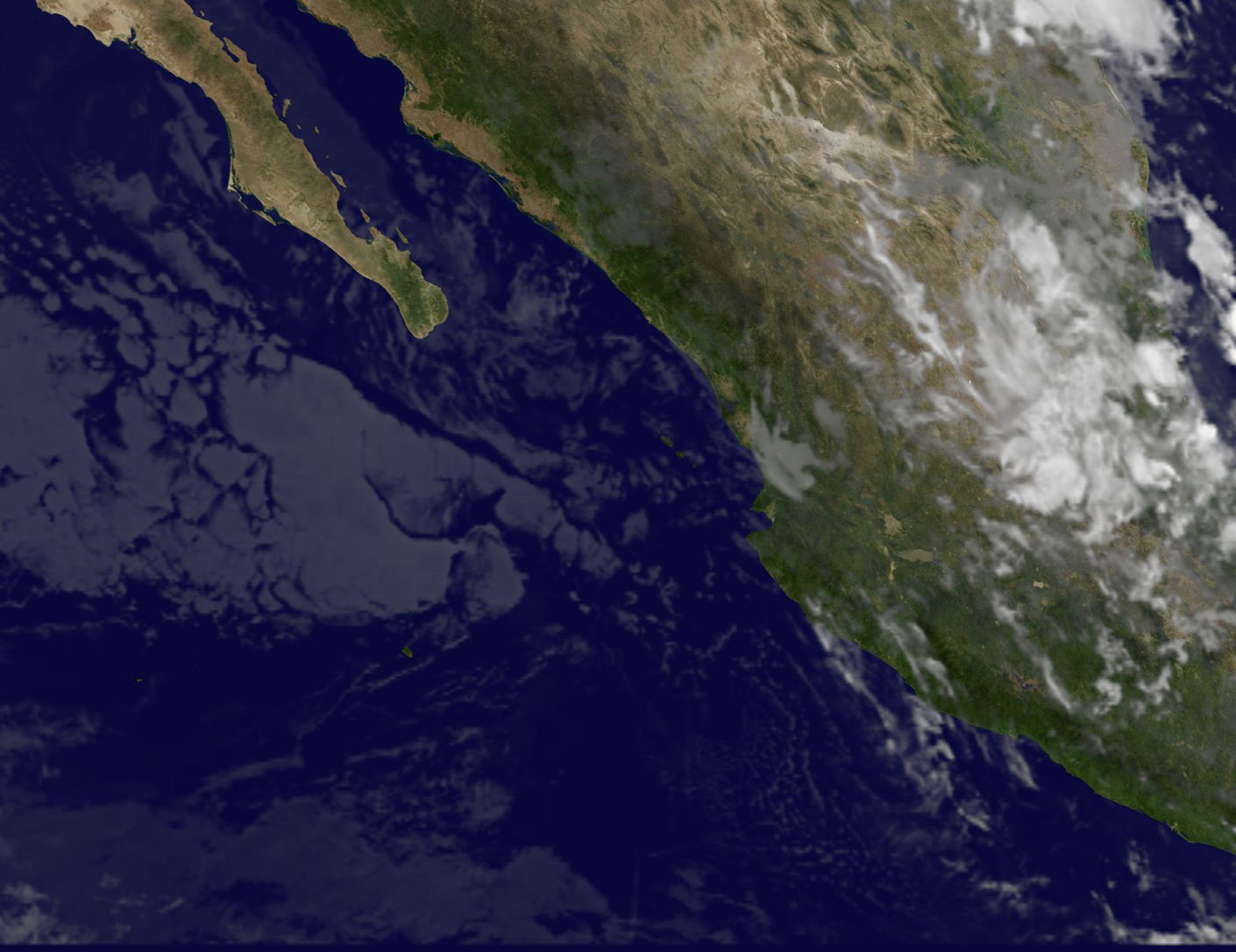
Tropical Storm Pilar formed near the southwestern coast of Mexico on Saturday, Sept. 23 and continued hugging the coast when NASA’s Terra and Aqua satellites passed overhead. Pilar weakened to a tropical depression during the late morning on Sept. 25.
The Moderate Resolution Imaging Spectroradiometer or MODIS instrument that flies aboard NASA’s Terra satellite captured a visible picture of Tropical Storm Pilar on Sept. 24 at 1:40 p.m. EDT (1740 UTC). At the time Pilar’s center was just off the coast of southwestern Mexico and the storm’s clouds and showers extended over the Mexican states of Jalisco, western Zacatecas, southern Sinaloa and southern Durango.
An infrared image of Pilar was taken from the Atmospheric Infrared Sounder or AIRS instrument aboard NASA’s Aqua satellite on Sept. 25 at 4:53 a.m. EDT (0853 UTC). AIRS measured cloud top temperatures with infrared light. The data showed some strong thunderstorms as cold as or colder than minus 63 degrees Fahrenheit (minus 53 Celsius) along the coast. NASA research has shown that storms with cloud tops that cold have the ability to produce heavy rainfall.
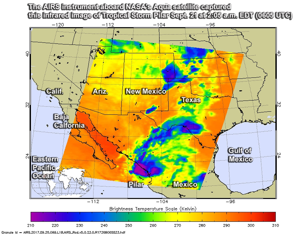
The National Hurricane Center (NHC) said that although Pilar weakened to a depression (after Aqua passed overhead), those strong storms are expected to bring locally heavy rainfall and flooding in the Mexican states of Nayarit, Sinaloa, and Durango.
At 9 a.m. MDT (11 a.m. EDT/1500 UTC), the center of Tropical Depression Pilar was located near 22.8 degrees north latitude and 107.0 degrees west longitude. That’s about 45 miles (75 km) southwest of Mazatlan, Mexico.
The depression is moving toward the north-northwest near 7 mph (11 kph) and this general motion is expected to continue for the next day or so until Pilar dissipates. On the forecast track, the center of Pilar is expected to remain just offshore of the coasts of the Mexican states of Nayarit and Sinaloa today.
Maximum sustained winds have decreased to near 35 mph (55 kph) with higher gusts. Additional weakening is forecast, and Pilar is expected to become a remnant low later today and dissipate by Tuesday, Sept. 26.
For forecast updates on Pilar, visit the National Hurricane Center website: www.nhc.noaa.gov.
By Rob Gutro
NASA’s Goddard Space Flight Center