


NASA Sees Mexico Almost “Paine-free”
Hurricane Paine weakened to a remnant low pressure area and appeared almost ghostly in infrared satellite imagery on Sept. 21 over the northern Baja California peninsula.
NOAA’s GOES-West satellite took an infrared image of Paine’s remnant clouds on Sept. 21 at 9:30 a.m. EDT (1330 UTC). The National Weather Service noted that Paine has quickly fallen apart and is now only a remnant low near the northern Baja coast. NOAA manages the GOES series of satellites. The image was created by the NASA/NOAA GOES Project at NASA’s Goddard Space Flight Center in Greenbelt, Maryland. The NASA/NOAA GOES Project uses data from the GOES series of satellites to produce images and animations.
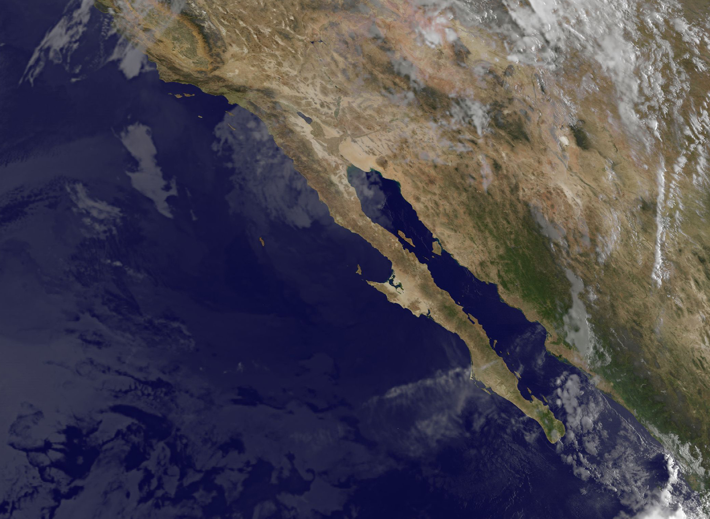
The final bulletin on Paine was issued by the National Hurricane Center (NHC) on Sept. 20 at 11 p.m. EDT. At that time, maximum sustained winds were near 35 mph (55 kph) and Paine was moving to the north at 12 mph (19 kph). Paine’s center was located about 85 miles (140 km) west of Punta Eugenia, Mexico.
The remnants of Paine are expected to produce additional rainfall amounts of between one half to one inch across the northern Baja California peninsula through today, Wednesday, Sept. 21. Isolated maximum storm total amounts of 6 inches are possible in association with Paine.
The National Hurricane Center noted that “rain well in advance of this system will continue to affect portions of southern California, Arizona, southern Utah, New Mexico, and southwestern Colorado with local maximum amounts of 1 to 3 inches possible, mainly over the favored higher terrain.”
Rob Gutro
NASA’s Goddard Space Flight Center
Sept. 20, 2016 – NASA Sees Paine Approaching Baja California, Mexico
NASA’s Aqua satellite passed over Hurricane Paine in the Eastern Pacific Ocean when it was still a Category 1 hurricane on the Saffir-Simpson Hurricane Wind Scale. Paine continued to weaken overnight and lost hurricane status by the next day as it continued nearing Baja California, Mexico.
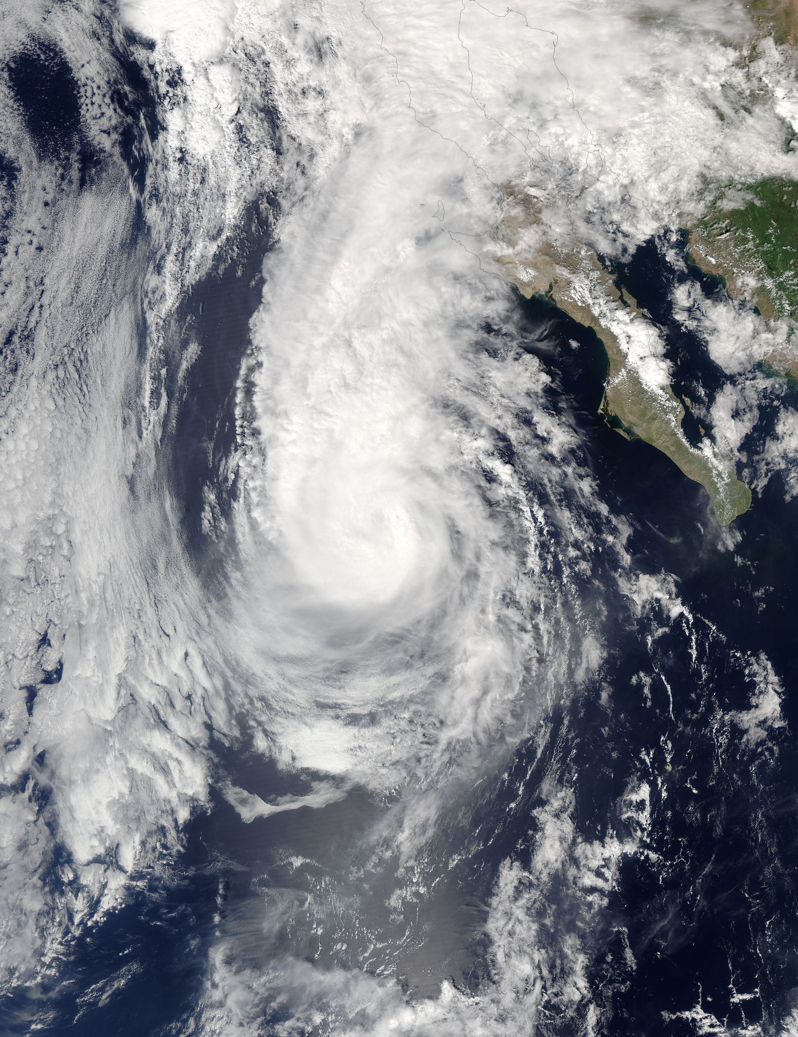
On Sept. 19 at 5 p.m. EDT (2100 UTC) the Moderate Resolution Imaging Spectroradiometer or MODIS instrument aboard NASA’s Aqua satellite captured a visible image of Paine nearing Baja California, Mexico. The image showed a ragged eye about 20 nautical miles in diameter. At the time, infrared imagery did shows vigorous thunderstorms, but with a less than circular shape. The strongest storms with the coldest cloud tops appeared in Paine’s western quadrant.
On Tuesday, Sept. 20 at 2 a.m. EDT, Paine weakened to a tropical storm. By 8 a.m. EDT a Tropical Storm Watch is in effect from Punta Eugenia to Cabo San Quintin, Mexico. A Tropical Storm Watch means that tropical storm conditions are possible within the watch area, in this case within 24 hours.
At 8 a.m. EDT (5 a.m. PDT/1200 UTC) the center of Tropical Storm Paine was located near 25.4 degrees north latitude and 116.8 degrees west longitude. That’s about 192 miles (315 km) south-southwest of Punta Eugenia, Mexico. The National Hurricane Center (NHC) said Paine is moving toward the north near 13 mph (20 kph), and this motion should continue today. A turn toward the north-northeast with a reduction in forward speed is expected tonight. On the forecast track, the center of Paine will approach the northwestern coast of the Baja California peninsula tonight or early Wednesday. Maximum sustained winds have decreased to near 50 mph (85 kph) with higher gusts.
The NHC said that “Continued rapid weakening is forecast during the next day or so, and Paine is expected to become a remnant low by Wednesday, Sept. 21.”
Rob Gutro
NASA’s Goddard Space Flight Center
Sept. 19. 2016 – Hurricane Paine at Peak Intensity But Not Threatening Land
Hurricane Paine began as a tropical depression (17E) on Saturday, September 17, 2016. It moved northwest at 16 mph and at that time it was expected to become a tropical storm by Sunday. Paine did become the sixteenth named storm in two and a half months by Sunday. Paine strengthened on Sunday the 18th and was predicted to become a hurricane by Monday. Paine became a hurricane during the early morning hours of Monday, September 19, 2016.
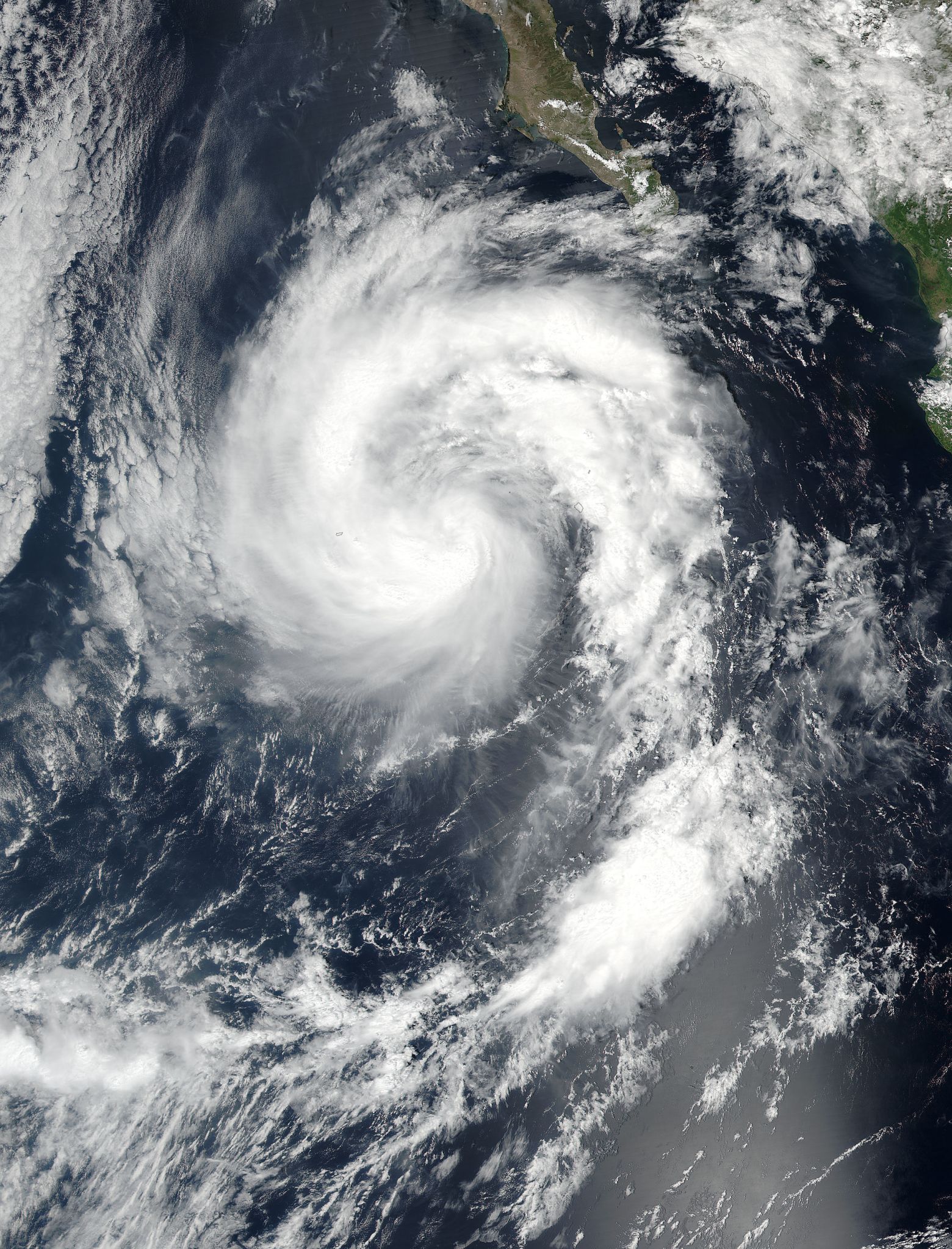
Currently Paine is located 340 miles west southwest of Cabo San Lucas, Mexico, but is threatening no land masses at present. Paine is moving at 13 knots with sustained winds of 65 to 80 knots. Winds in excess of 65 knots are extending out 90 miles from the center of the storm.
Paine will move north northwest and later north in the next 48 hours. The storm is at peak intensity but a weakening trend is forecast to begin later today. Adverse conditions as Paine moves over cooler waters will prompt its demise after 3 days, over the northern Baja California peninsula.
For more information on Paine go to the National Hurricane Center: http://www.nhc.noaa.gov
Lynn Jenner
NASA’s Goddard Space Flight Center