


These images illustrate how the Suomi National Polar-orbiting Partnership (Suomi NPP) satellite, a joint NASA/NOAA mission launched in 2011, circles Earth from pole-to-pole in a sun-synchronous orbit, with passes crossing the equator at the same local time.
It takes 14 orbits of the satellite to observe the entire Earth in one day, transmitting critical weather and climate data from its five instruments to Earth. This information enables weather forecasters and scientists to monitor and predict weather patterns with greater accuracy and to study long-term climate trends by extending the more than 30-year satellite data record.
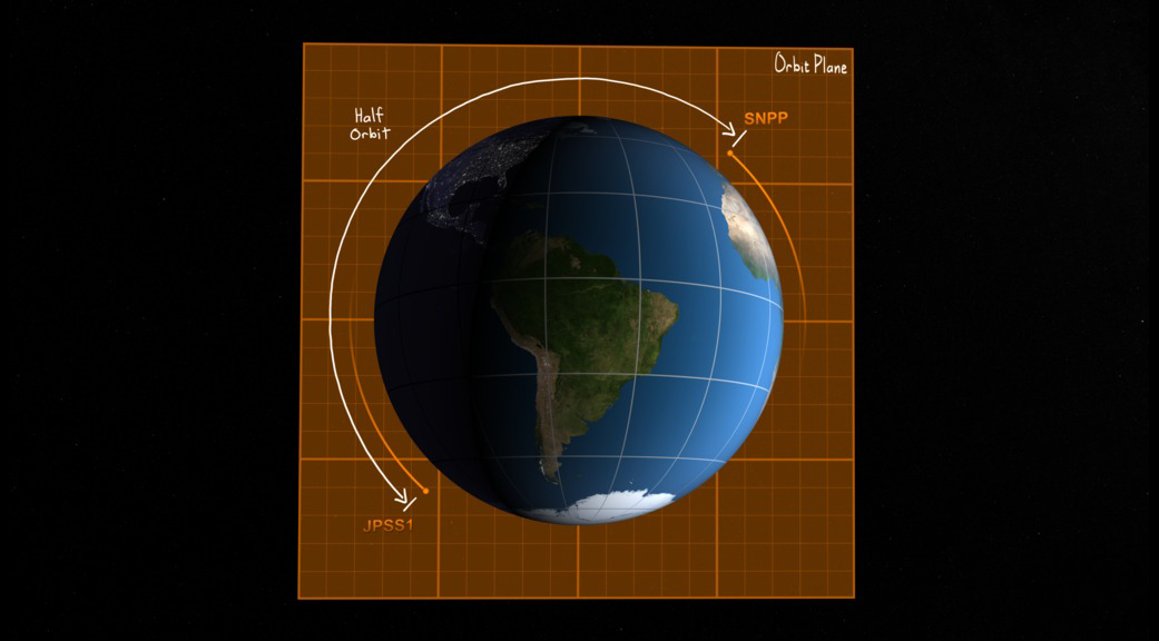
These images also show how the next satellite in the series, NOAA’s Joint Polar Satellite System-1 (JPSS-1) will be inserted into the same orbital plane as Suomi NPP, a half-orbit ahead of Suomi NPP, when it is launched in early 2017. This will enable JPSS-1 to orbit in tandem with Suomi NPP.
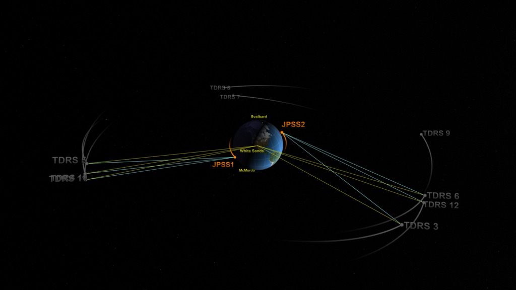
Suomi NPP’s satellite information is currently transmitted to antennas at a ground station in Svalbard, Norway near the North Pole. With JPSS-1, there will also be a transmission to antennas at McMurdo Station, Antarctica near the South Pole. With JPSS-2, communication links will also be provided by satellites within NASA’s Tracking and Data Relay Satellite (TDRS) network and the Svalbard, Norway ground station. The TDRS network, orbiting 22,300 miles above Earth, provides critical communication support to NASA’s human spaceflight endeavors and an array of science missions.
Additional imagery: http://svs.gsfc.nasa.gov/cgi-bin/details.cgi?aid=4430&button=recent
To learn more about JPSS, view satellite imagery, and the science behind the satellites, visit www.jpss.noaa.gov.
For more information on Suomi NPP and how it is used to study climate trends, visit https://www.nasa.gov/mission_pages/NPP/main/index.html.
For more information on TDRS, visit www.nasa.gov/mission_pages/tdrs/home/