


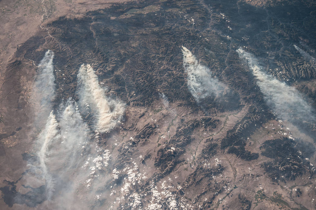
ISS036-E-032853 (18 Aug. 2013) — Central Idaho wildfires are featured in this image photographed by an Expedition 36 crew member on the International Space Station. Taken with a short lens (50 mm), this west-looking image covers much of forested central Idaho—the dark areas are all wooded mountains. The image highlights part of the largest single wilderness area in the contiguous United States (the Frank Church-River of No Return Wilderness). Within this mountainous region, several fires can be seen producing extensive smoke plumes. Some fires had been named by Aug. 20, 2013, two days after the image was taken. The densest smoke on that day appears to be generated by a combination of the Little Queens and Leggit fires (left, within the Salmon River Mountains). The named fires were mostly set by lightning, and on Aug. 20 totaled 53,000 acres of burned forest south of the Salmon River, and many more if the unnamed fires are included. The Gold Pan fire north of the Salmon River had burned 27,000 acres. For a sense of scale in this oblique view, the Gold Pan fire lies about 125 miles north of the Little Queens fire. This image shows the common pattern of westerly winds transporting smoke in an easterly direction, as seen during the wildfire season of one year ago. Ten days before this image was taken, fires in central Idaho near Boise were aggravated by southerly winds. Some of the fires began to burn in July but were quelled and remain under observation for new flare-ups. Smoke from fires in the south partly obscures the black lava flows of the Craters of the Moon National Monument (lower left). The Beaverhead Mountains mark the eastern boundary of Idaho with Montana.